| << Cookinseln - Tokelau-Inseln - Niue - Kermadecinseln |
||
|
||
Zuletzt angesehene Artikel:
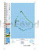
 | PI10 Manihiki (Cookinseln) Topographische Landkarte 1:25.000 - Land Information New Zealand |
 | 116 Slanske vrchy - Velka Domasa Wanderkarte Slowakei 1:50.000 - VKU |
 | Weserbergland - Höxter - Holzminden Topographische Wanderkarte mit Wanderwegen 1:25.000 - Nordrhein-Westfalen - ProjektNord |
 | Ätna - Alcantara - Simeto Touristische topographische Straßen- und Wanderkarte 1:50.000 Monte Etna - Carta escursionistica L.A.C. GlobalMap Italien |
 | 3238 Sandau (Elbe) Topographische Karte 1:25.000 Landesamt für Vermessung und Geoinformation Sachsen-Anhalt (Landesvermessungsamt) |
 | L7922 Bad Saulgau Topographische Landkarte 1:50.000 - Landesvermessungsamt Baden-Württemberg |
 | Aconcagua and the Southern Andes - The Highest Trek in the World - Wanderführer - Cicerone (englisch) |
 | DUMONT direkt Französische Atlantikküste von Jakubzig, Jacqueline |
 | 3435ET VALLOIRE / AIGUILLE D`ARVES / COL DU GALIBIER Topographische Wanderkarte Frankreich 1:25.000 TOP 25 IGN - (GPS) |
| M-34-6-A/B Grojec Amtliche topographische Landkarte Polen 1:50.000 M-34-6-A/B Grojec - Mapa Topograficzna Polski Glowny Geodeta Kraju |
 | 4351OT CERVIONE Topographische Wanderkarte Frankreich 1:25.000 TOP 25 IGN |
 | Osnabrück 2013 1:3.500/1:20.000 (Blatt 355) Bildstadtplan Bollmann-Bildkarten-Verlag |
 | 20 Valle di Rabbi 1:30.000 Wanderkarte - LIBRERIA ZANETTI - Italien |
| 32-c Topographische Landkarte Georgien 1:50.000 Geoland Maps Georgien |
 | 113 Okehampton - Wanderkarte Großbritannien 1:25.000 EXPLORER MAP - Ordnance Survey |
| M-34-59-A/B Krasnobrod Amtliche topographische Landkarte Polen 1:50.000 M-34-59-A/B Krasnobrod - Mapa Topograficzna Polski Glowny Geodeta Kraju |
 | 215 Samothraki 1:30.000 Landkarte Griechische Inseln - Road Editions - Griechenland |
 | 3048 Joachimsthal Topographische Karte 1:25.000 Landesvermessungsamt Brandenburg (gefaltet) |
 | 115 Rennes - St-Malo Topographische Touristische Landkarte Tourismus und Fahrrad (wasserfest) - tourisme et vélo plastifiée TOP100 - 1:100.000 - IGN Frankreich |
 | 72 Torsby 1:50.000 (wasserfest) Topographische Wanderkarte - Sverigeserien Topo50 - Schweden Kartförlaget |