| << Cookinseln - Tokelau-Inseln - Niue - Kermadecinseln |
||
|
||
Zuletzt angesehene Artikel:
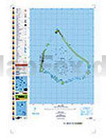
 | PI10 Manihiki (Cookinseln) Topographische Landkarte 1:25.000 - Land Information New Zealand |
 | DUMONT aktiv Wandern im Taunus von Etzel, Stefan |
 | Riviera di Ponente 1:160.000 (Blatt R-P) Straßenkarte Landkarte Italien RP Riviera di Ponente. Carte stradale della Riviera ligure di Ponente EdM - Edizioni del Magistero - Italien |
 | Gävle & Sandviken 1:50.000 *** SCHNÄPPCHEN *** Terrängkartan Calazo Förlag Schweden |
 | Gebiet Talas - Landkarte 1:400.000 Talas oblast 1:400 000 - Kirgisistan |
 | Dahlener Heide (Blatt 17a) Topographische Wanderkarte 1:30.000 mit Wanderwegen - ProjektNord |
 | 2 Holstein - Hamburg ADFC-Radtourenkarte 1:150.000 Bielefelder Verlag |
 | 1281 COPPET 1:25.000 Topographische Landeskarte der Schweiz - swisstopo |
 | 3335ETR LE BOURG-D`OISANS Topographische Wanderkarte Frankreich 1:25.000 (LAMINIERTE AUSGABE) TOP 25 IGN - (GPS) |
| 2647-SO Topographische Karte 1:10.000 - Landesvermessungsamt Brandenburg |
| 2741-SO Topographische Karte 1:10.000 - Landesvermessungsamt Brandenburg |
 | 4718SB Pointe Behague - Topographische Wanderkarte Französisch Guayana 1:25.000 TOP 25 - (GPS) Pointe Behague IGN Frankreich |
| 2648-SO Topographische Karte 1:10.000 - Landesvermessungsamt Brandenburg |
 | Südamerika - Nord 1:3.85 Mio. Landkarte - ITMB International Travel Maps (engl.) South America - North |
| 2748-SO Topographische Karte 1:10.000 - Landesvermessungsamt Brandenburg |
| 2741-NO Topographische Karte 1:10.000 - Landesvermessungsamt Brandenburg |
| 2835-NO Topographische Karte 1:10.000 - Landesvermessungsamt Brandenburg |
| 2652-SO Topographische Karte 1:10.000 - Landesvermessungsamt Brandenburg |
 | 457 Gesenke - Reichensteiner Gebirge Wanderkarte Tschechien 1:40.000 - SHOCart Jeseníky - Rychlebské hory - SHOCart |
 | Gebiet Tschüi - Landkarte 1:500.000 Chüy oblast 1:500 000 - Kirgisistan |