| << Italien: Wanderführer und Reiseführer << Societa Editrice Ricerche - Italien |
||
|
||
Zuletzt angesehene Artikel:
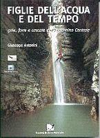
 | Figlie dell`acqua e del tempo Wanderführer (italienisch) SOCIETA EDITRICE RICERCHE (SER) - Italien |
 | Glyndwr`s Way A-Z Adventure Atlas 1:25.000 Wanderatlas Geographers` A-Z GroÃbritannien |
 | Nordost-Afrika / Arabien StraÃenkarte 1:4 Mio. (Blatt 745) Michelin |
 | 1 Troisvierges - Houffalize - Clerf 1:40.000 mit Wanderwegen - Wanderkarte Luxemburg - ProjektNord |
 | Libin NGI 1:25.000 Touristische Landkarte und Wanderkarte Belgien |
 | PI11 Aitutaki (Cookinseln) Topographische Landkarte 1:25.000 - Land Information New Zealand |
 | 102 S Grip SÃR 1:50.000 - Amtliche Topographische Landkarte Norwegen - Startens Kartverk |
 | Neutitschein 1:12.000 Stadtplan Novy Jicin a Okoli SHOCart Tschechien |
 | PI07 Palmerston (Cookinseln) Topographische Landkarte 1:25.000 - Land Information New Zealand |
 | Mittelamerika - Karibische Inseln - Mexiko 1:6 Mio. CENTRAL AMERICA - CARIBBEAN ISLANDS - MEXICO - Internationale Landkarte - Cartographia |
 | Herzstoà Roman. Psychothriller. Ãbersetzung: Lutze, Kristian - von Joy Fielding - Goldmann |
| 1189 Powunden Topographische Karte 1:25.000 Messtischblatt des Deutschen Reiches - PreuÃische Landesaufnahme / Reichsamt für Landesaufnahme - Faksimile ProjektNord |
 | 0190 O BARCO Topographische Landkarte 1:50.000 Spanien (Grundlage MTN50) Instituto Geográfico Nacional - CNIG Spanien - ProjektNord |
 | 259 bis Glurns/Glorenza 1:50.000 - Vinschgau/Val Venosta - Stilfser Joch/Giogo dello Stelvia - Topographische Landeskarte der Schweiz - swisstopo |
| Ryfylkefjordane - Sjernarøyane - Sauda - Seekarte Norwegische Küste 1:50.000 - (Blatt 15) Den Norske Kyst Sjøkart - Hovedkart (sjø) Statens Kartverk Sjø - Norwegen |
 | Sankt Petersburg - Leningrader Oblast Stadtplan-Atlas / StraÃenatlas 1:35.000 / 1:750.000 Санкт-Петербург. Ленинградская область Rus Co. Ltd. |
 | 69 Barcelos - Topographische Landkarte Portugal 1:25.000 Carta Militar de Portugal - Série M888 Instituto Geográfico do Exército (IGeoE) - Portugal |
 | K12 Abensberg - mit Pförring, Neustadt a.d.Donau, Aiglsbach, Münchsmünster, Siegenburg, Elsendorf ATK25 Topographische Karte 1:25.000 (Atkis) Bayern Landesvermessungsamt Bayern - Wanderkarte |
 | Konya - Karaman - Ereğli - Topographische Reisekarte 1:250.000 Türkei (Blatt 20) mit Wanderwegen - Landkarte Konya - Karaman - Ereğli ProjektNord |
 | 4319 Lichtenau (geplottete Ausgabe) Amtliche topographische Karte 1:25.000 Landesvermessungsamt Nordrhein-Westfalen |