| << Cookinseln - Tokelau-Inseln - Niue - Kermadecinseln |
||
|
||
Zuletzt angesehene Artikel:
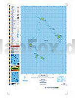
 | PI07 Palmerston (Cookinseln) Topographische Landkarte 1:25.000 - Land Information New Zealand |
 | Mittelamerika - Karibische Inseln - Mexiko 1:6 Mio. CENTRAL AMERICA - CARIBBEAN ISLANDS - MEXICO - Internationale Landkarte - Cartographia |
 | Herzstoà Roman. Psychothriller. Ãbersetzung: Lutze, Kristian - von Joy Fielding - Goldmann |
 | 1189 Powunden Topographische Karte 1:25.000 Messtischblatt des Deutschen Reiches - PreuÃische Landesaufnahme / Reichsamt für Landesaufnahme - Faksimile ProjektNord |
 | 0190 O BARCO Topographische Landkarte 1:50.000 Spanien (Grundlage MTN50) Instituto Geográfico Nacional - CNIG Spanien - ProjektNord |
 | 259 bis Glurns/Glorenza 1:50.000 - Vinschgau/Val Venosta - Stilfser Joch/Giogo dello Stelvia - Topographische Landeskarte der Schweiz - swisstopo |
| Ryfylkefjordane - Sjernarøyane - Sauda - Seekarte Norwegische Küste 1:50.000 - (Blatt 15) Den Norske Kyst Sjøkart - Hovedkart (sjø) Statens Kartverk Sjø - Norwegen |
 | Sankt Petersburg - Leningrader Oblast Stadtplan-Atlas / StraÃenatlas 1:35.000 / 1:750.000 Санкт-Петербург. Ленинградская область Rus Co. Ltd. |
 | 69 Barcelos - Topographische Landkarte Portugal 1:25.000 Carta Militar de Portugal - Série M888 Instituto Geográfico do Exército (IGeoE) - Portugal |
 | K12 Abensberg - mit Pförring, Neustadt a.d.Donau, Aiglsbach, Münchsmünster, Siegenburg, Elsendorf ATK25 Topographische Karte 1:25.000 (Atkis) Bayern Landesvermessungsamt Bayern - Wanderkarte |
 | Konya - Karaman - Ereğli - Topographische Reisekarte 1:250.000 Türkei (Blatt 20) mit Wanderwegen - Landkarte Konya - Karaman - Ereğli ProjektNord |
 | 4319 Lichtenau (geplottete Ausgabe) Amtliche topographische Karte 1:25.000 Landesvermessungsamt Nordrhein-Westfalen |
 | NL 33-01-08 Ost (3208-Ost) Ruhpolding Ãsterreichische Karte 1:25.000 mit Wegmarkierungen (topographische Wanderkarte - UTM) - BEV - Ãsterreich - VergröÃerung (ÃK25V) |
 | 14 Drenthe midden - Fahrradkarte 1:66.666 Drenthe midden fietskaart Drenthe midden - ANWB fietskaart 14 - ANWB - Niederlande |
 | Frangokastello - Plakias - Lefka Ori (WeiÃe Berge) - (Blatt 11.17) Topografische Bergwanderkarte Kreta - Griechenland 1:25.000 - Greece - Crete - Anavasi - Griechenland Φρανκοκαστελο - Πλακιας - Lefka Ori - ΠΕΖΟΠΟΡΙΚΟΣ ΧΑΡΤΗΣ - Hiking Map |
 | 81-II Potes Amtliche topographische Landkarte 1:25.000 Spanien (M.T.N.) 81-II Mapa Topográfico Nacional de Espana (MTN25) Instituto Geográfico Nacional - CNIG Spanien |
| Aukstadvaris (65-69/25-29) Topografische Karte Litauen 1:50.000 Lietuvos Respublikos Topografinis Zemelapis 1:50.000 - Nacionaline Zemes Tarnyba - Litauen |
 | Niedere Tatra Chopok - Dumbier - Certovica 1:25.000 Topographische Wanderkarte (Blatt 2505) Nizke Tatry Chopok - Dumbier - Certovica Tatraplan - Dukát |
 | Dalmatinische Küste, Rijeka - Cres - Krk - Kornaten - Zadar - Split - Brac - Dubrovnik 1:150.000 Auto + Freizeitkarte Costa dalmata - Cote Dalmatie Dalmatische kust - Dalmatian Coast - Cote d` Dalma freytag & berndt |
| 1630 Hohwacht - Gestern und Heute - Historische Ãberlagerung 1878-1880 Topographische Landkarte 1:25.000 im Vergleich - Landesvermessungsamt Schleswig-Holstein / ProjektNord |