| << Finnland << Genimap / Karttakeskus Finnland |
||
|
||

Zuletzt angesehene Artikel:
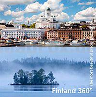
 | Finland 360° The most beautiful places and sights - Bildband Karttakeskus - Genimap Finnland |
 | Hardangervidda outdoor map - hiking - skiing - MTB - laminiert Touristische topographische Outdoorkarte Norwegen 1:150.000 - wasserfest - von Frank Brandl - Wanderkarte ProjektNord |
 | 5565 Glatz Topographische Karte 1:25.000 Messtischblatt des Deutschen Reiches - Preußische Landesaufnahme / Reichsamt für Landesaufnahme - Faksimile ProjektNord |
| 5569 Neisse (West) Topographische Karte 1:25.000 Messtischblatt des Deutschen Reiches - Preußische Landesaufnahme / Reichsamt für Landesaufnahme - Faksimile ProjektNord |
 | 4221 Brakel (geplottete Ausgabe) Amtliche topographische Karte 1:25.000 Landesvermessungsamt Nordrhein-Westfalen |
 | Finistère - Les 30 plus beaux sentiers - Balades à pied Wanderführer - (französisch) Chamina - Frankreich |
| 2477 Warlubien Topographische Karte 1:25.000 Messtischblatt des Deutschen Reiches - Preußische Landesaufnahme / Reichsamt für Landesaufnahme - Faksimile ProjektNord |
 | 0793 Skirwiet Topographische Karte 1:25.000 Messtischblatt des Deutschen Reiches - Preußische Landesaufnahme / Reichsamt für Landesaufnahme - Faksimile ProjektNord |
 | 68 Skaftartunga Topographische Karte Island 1:100.000 - Ferdakort 68 SKAFTÁRTUNGA - Atlaskort - Ferðakort |
| 3472 Tremessen Topographische Karte 1:25.000 Messtischblatt des Deutschen Reiches - Preußische Landesaufnahme / Reichsamt für Landesaufnahme - Faksimile ProjektNord |
 | 5 Nürnberg West - Steigerwald - Rothenburg ob der Tauber - Landkarte 1:100.000 (ATK100) Amtliche topographische Karte Bayern - Landesvermessungsamt Bayern |
 | 15 Slovenj Gradec - Topographische Landkarte Slowenien 1:50.000 - Amtliche Kartengrundlage ProjektNord |
 | Hauptfriedhof Wanderungen - Wege - Wissenswertes zum großen Dortmunder Parkfriedhof - Touristische Landkarte - Verlag Kartenwerk |
 | ADAC CityAtlas Hamburg 1:15.000 |
 | Italy Best Day Walks Reiseführer Lonely Planet (engl.) |
 | Rad ab 2 - Zum zweiten Mal mit dem Rad um die Welt - Vier Jahre - 68 Länder und 88.000 Kilometer - von Peter Smolka - Reise-Know-How Verlag |
 | Safer Ski Touring: Norway (englisch) - Fri Flyt AS A guide to 111 Norwegian mountains where you can avoid avalanche terrain |
 | 61 Westliches Thüringer Becken Topographische Karte Thüringen 1:50.000 - Thüringer Landesvermessungsamt - Wanderkarte mit Wanderwegen |
 | Insel Usedom, Karlshagen, Zinnowitz, Peenemünde, Wolgast und Umgebung - Radwander- und Wanderkarte 1:35.000 (Nr. 177) Ausflüge im Gebiet der Usedomer Bernsteinbäder und Inselbäder, Radwander- und Wanderkarte. GPS-fähig. 1:35000 Dr. Barthel Verlag |
| Day Walks in Somerset Vertebrate Publishing |