| << Finnland << Genimap / Karttakeskus Finnland |
||
|
||

Zuletzt angesehene Artikel:
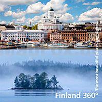
 | Finland 360° The most beautiful places and sights - Bildband Karttakeskus - Genimap Finnland |
 | Salomonen 1:910.000 - Südlicher Pazifischer Ozean 1:12 Mio. Landkarte - ITMB International Travel Maps (engl.) Solomon Islands |
 | Pilgerwandern nach Santiago de Compostela Wanderführer schwedisch - Calazo Förlag Pilgrimsvandra till Santiago de Compostela Calazo Förlag Schweden |
 | Osaka Stadtplan 1:12.500 / Japan West Landkarte 1:600.000 Stadtplan - ITMB International Travel Maps (engl.) Osaka - Western Japan |
 | L6728 Ansbach (geplottete Ausgabe) Topographische Karte Bayern 1:50.000 Bayerisches Landesvermessungsamt |
 | Eifel Nord - Aachen - Köln 1:75.000 - Aachen - Düren - Eupen - Ahr - Erft - Rur - Zülpicher Börde (Blatt RK-NRW06) Bikeline Radkarte - Esterbauer |
 | 4552 Weißkollm Amtliche Topographische Landkarte 1:25.000 (Präsentationsgrafik) - Landesvermessungsamt Sachsen |
 | 3: Calais - Le Touquet - Fahrradkarte 1:75.000 Calais - Le Touquet fietskaart Alta Via - Frankreich |
| 321.33 Miedzyzdroje (Misdroy) Amtliche topographische Karte 1:25.000 Polen |
 | Schorfheide Nord Topographische Wanderkarte mit Wanderwegen und Radwegen 1:35.000 - ProjektNord |
 | L6742 Waldmünchen (geplottete Ausgabe) Topographische Karte Bayern 1:50.000 Bayerisches Landesvermessungsamt |
 | 2624 Hollenstedt Amtliche topographische Karte 1:25.000 Landesvermessungsamt Niedersachsen |
 | San Gabriel Valley / Pasadena / Arcadia Stadtplan 1:32.000 (Kalifornien - USA) San Gabriel Valley / Pasadena / El Monte street map Global Graphics / GM Johnson |
 | Woiwodschaft Lodz Landkarte 1:250.000 Łódzkie mapa województwa Demart - Polen |
 | Glacier-Waterton Lakes National Parks - Montana - Alberta 1:100.000 - Blatt 215 Landkarte - Trails Illustrated Map - National Geographic |
| 4653 Klitten Amtliche Topographische Landkarte 1:25.000 (Präsentationsgrafik) - Landesvermessungsamt Sachsen |
| 4454 Bad Muskau Amtliche Topographische Landkarte 1:25.000 (Präsentationsgrafik) - Landesvermessungsamt Sachsen |
| M-33-43-C/D Liberec Amtliche topographische Landkarte Polen 1:50.000 M-33-43-C/D Liberec - Mapa Topograficzna Polski Glowny Geodeta Kraju |
 | 2931 Zernien Amtliche topographische Karte 1:25.000 Landesvermessungsamt Niedersachsen |
 | 10: Skäckerfjällen - Storlien - Åre 1:75.000 - Outdoorkarte / Fjällkarte - wasserfest Norstedts - Schweden |