| << Publicpress - Freytag u Berndt |
  | |
Zuletzt angesehene Artikel:
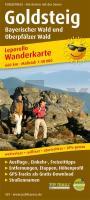
![]() | Goldsteig, Bayerischer Wald und Oberpfälzer Wald Leporello Wanderkarte mit Ausflugszielen, Einkehr- & Freizeittipps, wetterfest, reissfest, abwischbar, GPS-genau. 1:50000 - von - Freytag-Berndt und ARTARIA Publicpress |
![]() | Rhein-Radweg 1: Andermatt - Basel 1:75.000 bikeline Radwanderführer - Esterbauer |
![]() | 4167 Seide Topographische Karte 1:25.000 Messtischblatt des Deutschen Reiches - Preußische Landesaufnahme / Reichsamt für Landesaufnahme - Faksimile ProjektNord |
![]() | 30 Villaviciosa Amtliche topographische Landkarte 1:50.000 Spanien (M.T.N.) 30 Mapa Topográfico Nacional de Espana (MTN50) Instituto Geográfico Nacional - CNIG Spanien |
![]() | Riviera di Ponente da Finale Ligure ad Albenga - Alpi Marittime e Liguri - Topographische Wanderkarte 1:25.000 (Blatt 104) Carta dei Sentieri e Rifugi - Edizioni Multigraphic - Italien |
![]() | 4766 Dyhernfurth Topographische Karte 1:25.000 Messtischblatt des Deutschen Reiches - Preußische Landesaufnahme / Reichsamt für Landesaufnahme - Faksimile ProjektNord |
![]() | 4451-SO Topographische Karte 1:10.000 - Landesvermessungsamt Brandenburg |
![]() | Senton Portage - TOPO (Blatt VCBC43) Topographische Landkarte - Backroad Topo Map Kanada |
![]() | MN28 Masivul Feleacu 1:45.000 Topographische Wanderkarte (englisch / rumänisch) Hiking Map of Feleacu Massif - Harta de drumeţie a Masivului Feleacu Muntii Nostri - Schubert & Franzke - Rumänien |
![]() | NL 32-06-01 (2101) Gaschurn Österreichische Karte 1:50.000 mit Wegmarkierungen (topographische Wanderkarte - UTM) - BEV - Österreich |
![]() | DuMont direkt Normandie von Simon, Klaus |
![]() | Mosambik 1:2 Mio. MOZAMBIQUE - Internationale Landkarte - Cartographia |
![]() | Oblast Kostroma 1:500.000 Straßenkarte / Regionalkarte - Russland Костромская область Rus Co. Ltd. |
![]() | M4224 Kaanaa Topographische Karte 1:25.000 EUREF (Peruskartta) Maanmittauslaitos / Lantmäteriverket Finnland - ProjektNord |
![]() | Moselsteig Karte SET (Blätter 1-3) Perl - Trier - Zell (Mosel) - Koblenz (MS1-3) Topographische Landkarten 1:25 000 mit Wander- und Radwanderwegen mit dem Moselsteig von Trier bis Zell - Landesvermessungsamt Rheinland-Pfalz |
![]() | 29 Ferrières - Hamoir - Sy - Barvaux - 1:25.000 Touristische Landkarte und Wanderkarte, Radwanderkarte, Reitkarte - Mini Ardenne - Belgien |
![]() | 432.11 Amtliche topographische Karte 1:25.000 Polen |
![]() | 369 Perth & Kinross - Ochil Hills East & Loch Leven - Wanderkarte Großbritannien 1:25.000 EXPLORER MAP - Ordnance Survey |
![]() | 3732 10 Seitajärvi Topographische Karte 1:20.000 (Maastokartta / Peruskartta / Grundkarta) Maanmittauslaitos / Lantmäteriverket Finnland - ProjektNord |
![]() | 461.1 Lesna Amtliche topographische Karte 1:50.000 Polen |


