| << Tasmap << Tasmanien |
||
|
||

Zuletzt angesehene Artikel:
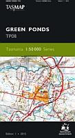
 | TP08 Green Ponds 1:50.000 Topographische Landkarte Tasmanien - Australien - Tasmap (Tasmanien) |
 | TL05 Murchison 1:50.000 Topographische Landkarte Tasmanien - Australien - Tasmap (Tasmanien) |
 | 366.11 Amtliche topographische Karte 1:25.000 Polen |
 | HAUT-RHIN / TERRITOIRE-DE-BELFORT (Blatt D68-90) Département-Landkarte Frankreich 1:100.000 HAUT-RHIN/TER.DE-BELFORT - Carte départementale - IGN Frankreich |
 | 329 Lowther Hills - Sanquhar & Leadhills - Wanderkarte GroÃbritannien 1:25.000 EXPLORER MAP - Ordnance Survey |
 | 37/7-8 ANTOING - LEUZE-EN-HAINAUT NGI 1:20.000 Topographische Landkarte Belgien |
 | 2836OT GERBIER DE JONC / MEZENC Topographische Wanderkarte Frankreich 1:25.000 TOP 25 IGN |
| 3128 E SAINT AMOUR GPS Amtliche Topographische Wanderkarte Frankreich 1:25.000 - série bleue (IGN) |
 | Masuren - Krutynia und Spirdingsee Touristenkarte 1:60.000 - GPS (Papierausgabe) MAZURY - szlak Krutyni Jezioro Sniardwy Compass - Polen |
| 3839 Reppinichen Topographische Karte 1:25.000 Landesamt für Vermessung und Geoinformation Sachsen-Anhalt (Landesvermessungsamt) |
| 3317SB Châtenois - Rouvres-en-Xaintois GPS Amtliche Topographische Wanderkarte Frankreich 1:25.000 - série bleue (IGN) |
 | 3112ET FORETS DE VERDUN ET DU MORT-HOMME Topographische Wanderkarte Frankreich 1:25.000 TOP 25 IGN - (GPS) |
 | 3334OTR MASSIF DE LA CHARTREUSE SUD Topographische Wanderkarte Frankreich 1:25.000 (LAMINIERTE AUSGABE) TOP 25 IGN - (GPS) |
 | Yundola - Touristische Karte der westlichen Rhodopen 1:30.000 Topographische Wanderkarte Юндола - Туристическа карта / Yundola - turistitscheska karta Oilaripi Bulgarien |
 | Sulovske vrchy - Javornik-Gebirge 1:50.000 (Blatt 5016) Wanderkarte Súľovské vrchy, JavornÃky TatraPlan - Slowakei |
 | 3: Grupo Morado 1:25.000 - Valles del Morado y de Morales - Cajón del Maipo - Trekkingkarte - Andes-handbook - Chile |
| 303 (INT 931) Seekarte 303 Oversejlingskart Statens Kartverk Sjø - Norwegen |
 | 292 Withernsea & Spurn Head - Wanderkarte GroÃbritannien 1:25.000 EXPLORER MAP - Ordnance Survey |
 | Sizilien - Touristische StraÃenkarte 1:200.000 (Blatt 14) Sicilia - Carta stradale e turistica Touring-Club Italiano (TCI) Italien |
| Støtt - Saltfjorden - Seekarte Norwegische Küste 1:50.000 - (Blatt 64) Den Norske Kyst Sjøkart - Hovedkart (sjø) Statens Kartverk Sjø - Norwegen |