Willkommen bei MapFox
Wurde Ihre Bestellung bestätigt? Wenn nicht - gab es evtl. ein SERVER-Problem! Bitte kontaktieren Sie uns! +++ Buchhändler-Anfragen erwünscht +++
Warenkorb
Artikel: 0 - € 0.00
Zur Kasse
Impressum Kontakt Versandkosten AGB
Kapstadt - 101 Ausflugsziele im Umkreis von 200 Km Straßenkarte 1:425.000 slingsby´s
Day drives from Cape Town - 101 destinations 200 km or less from the city centre
<< Südafrika
<< slingsby´s (Tracks4Africa) - Südafrika
 
Cover

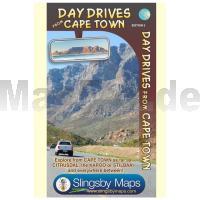
Diese Straßenkarte (1:400.000) für Tagesausflüge in die Umgebung von Kapstadt wird im Norden ewas oberhalb der St. Helena-Bucht und im Süden und Osten an dem Küstenpunkt "Qouin Point", der etwa 35 km südwestlich von Gansbai gelegen ist, begrenzt.

Die Karte und die Listen auf der Rückseite bieten über 100 Vorschläge für Tagestouren aller Art um Kapstadt herum.

Die Entfernungs- und Fahrtangaben sind vollständig vor Ort recherchiert.


Zusatzkarten:

- Cape Penninsula 1:200.000
- Worcester
- Wellington
- Malmesbury
- Stellenbosch

Kartenausschnitt

Kartenbeispiel

Kapstadt - 101 Ausflugsziele im Umkreis von 200 Km Straßenkarte 1:425.000 slingsby´s
Day drives from Cape Town - 101 destinations 200 km or less from the city centre
EAN / ISBN: 9781920377342
Preis: EUR 27.90

Bestellartikel: versandfertig in ca. 1-3 Wochen. Dieser Artikel wird speziell für Sie bestellt. Keine Rücknahme!
Produkt EUR Anzahl Bestellen
Kapstadt - 101 Ausflugsziele im Umkreis von 200 Km Straßenkarte 1:425.000 slingsby´s
Day drives from Cape Town - 101 destinations 200 km or less from the city centre
27.90
Versandkostenfrei in Deutschland ab 30,- Bestellwert

incl. MwSt.

Stichworte, die bei der Suche nützlich sein könnten:
Stellenbosch - Kapstadt - Cape Town - Worcester - Wellington - South Africa - Kap Halbinsel - Südafrika - Cape Penninsula - Malmesbury - Südafrika - slingsby´s - Slingsbys - Südafrika Landkarten - South Africa maps - Südafrika Wanderkarten - südafrikanische Karten - Südafrika-Karten

Zuletzt angesehene Artikel:

CoverKapstadt - 101 Ausflugsziele im Umkreis von 200 Km Straßenkarte 1:425.000 slingsby´s
Day drives from Cape Town - 101 destinations 200 km or less from the city centre

CoverPalermo Stadtplan 1:12.500 (wasserfest) Touring-Club Italiano (TCI) Italien

CoverEmilia Romagna 1:200.000 Straßenkarte Italien (Blatt 357)
Emilia - Romagna Michelin Local

Cover3531ETR SAINT-GERVAIS-LES-BAINS Topographische Wanderkarte Frankreich 1:25.000 (LAMINIERTE AUSGABE) TOP 25 IGN - (GPS)

Cover3741OT VALLEE DE LA VESUBIE Topographische Wanderkarte Frankreich 1:25.000 TOP 25 IGN - (GPS)

Noch kein Cover vorhandenSikkim (Himalaya) 1:150.000 North-East India (Kangchenjunga, Darjeeling) SCHWEIZERISCHE STIFTUNG FÜR ALPINE FORSCHUNG (SSAF)

Cover49 SPA NGI 1:50.000 Topographische Karte Belgien

Noch kein Cover vorhanden4253OT PETRETO-BICCHISANO/ZICAVO Topographische Wanderkarte Frankreich 1:25.000 TOP 25 IGN

CoverRund um den Georgsberg (Blatt 100) Topographische Wanderkarte 1:25.000 EUROKART (tschechisch)
Podřipsko Geodezie On Line - Tschechien

Cover1821 Albersdorf Topographische Landkarte 1:25.000 Landesvermessungsamt Schleswig-Holstein

CoverProvinz Taschkent / Toshkent Landkarte 1:500.000
Toškent viloyati - Usbekistan

CoverPI05 Pukapuka (Cookinseln) Topographische Landkarte 1:25.000 - Land Information New Zealand

CoverGorski kotar 2 - Nationalpark Risnjak mit Wanderwegen und Radwegen - Wanderkarte - Fahrradkarte 1:35.000 Kroatien - ProjektNord
Gorski kotar 2 - Nacionalni park Risnjak ProjektNord

CoverKapstadt und Kaphalbinsel Straßenatlas 1:20.000 (Spiralo) MapStudio Südafrika

Noch kein Cover vorhanden2785 07A Banepa (47) 1:25.000 Kathmandu Valley Trek FINN MAPS - HMG Nepal

CoverSlowenien - Kroatien - Bosnien-Herzigowina - Serbien - Montenegro - Mazedonien Nord 1:1 Mio. Straßenkarte (Blatt 736) Michelin

CoverUSA North-East & Canada East Straßenkarte 1:2.4 Mio. (Blatt 583) Michelin Regional USA

CoverChile - Argentinien 1:2 Mio. Straßenkarte (Blatt 788)
Chili - Argentina Michelin

Noch kein Cover vorhanden2014SB Saint-André-de-l`Eure - Nonancourt GPS Amtliche Topographische Wanderkarte Frankreich 1:25.000 - série bleue (IGN)

Noch kein Cover vorhanden3133 Pretzier Topographische Karte 1:25.000 Landesamt für Vermessung und Geoinformation Sachsen-Anhalt (Landesvermessungsamt)