| << Russland: Oblaste und Regionen etc. << Rus Co. Ltd. |
||
|
||
Zuletzt angesehene Artikel:
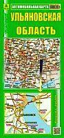
 | Oblast Uljanowsk 1:450.000 Straßenkarte / Regionalkarte - Russland Ulyanowskaya oblast Rus Co. Ltd. |
 | 445 - Topographische Landkarte Portugal 1:25.000 Carta Militar de Portugal - Série M888 Instituto Geográfico do Exército (IGeoE) - Portugal |
 | T5312 Juuma Topographische Karte 1:25.000 EUREF (Peruskartta) Maanmittauslaitos / Lantmäteriverket Finnland - ProjektNord |
 | 8626 Hoher Ifen Topographische Landkarte Bayern 1:25.000 - Normalausgabe - ProjektNord (geplottete Ausgabe) - Grundlage amtliche Topographische Karte Bayern DTK25 |
 | 6137 Kemnath Topographische Landkarte Bayern 1:25.000 - Normalausgabe - ProjektNord (geplottete Ausgabe) - Grundlage amtliche Topographische Karte Bayern DTK25 |
 | Karadsch - Touristischer Stadtplan-Atlas Zentrum und Gemeinde (Nr. 392) Straßenatlas Englisch und Persisch اطلس گردشگري شهر و شهرستان كرج - Tourist Atlas of Karaj City & Township Gitashenasi - Iran |
 | 5836 Münchberg Topographische Landkarte Bayern 1:25.000 - Normalausgabe - ProjektNord (geplottete Ausgabe) - Grundlage amtliche Topographische Karte Bayern DTK25 |
 | 705 Trujillo Amtliche topographische Landkarte 1:50.000 Spanien (M.T.N.) 705 Mapa Topográfico Nacional de Espana (MTN50) Instituto Geográfico Nacional - CNIG Spanien |
 | 2413-IV Kalundborg - mit Wanderwegen und Fahrradrouten Topographische Fahrradkarte und Wanderkarte Dänemark 1:50.000 - Kort & Matrikelstyrelsen ProjektNord 2413-IV Kalundborg - Topografisk Cykel- og Vandrekort Danmark |
 | Krasnopol Topographische Karte 1:25.000 Messtischblatt des Deutschen Reiches - Preußische Landesaufnahme / Reichsamt für Landesaufnahme - Faksimile ProjektNord |
| 115I - Carmacks Topographische Landkarte 1:250.000 - Canada - Yukon |
 | Lorestan - Touristische Landkarte - Provinz-Straßenkarte 1:300.000 (Blatt 191) Landkarte / Straßenkarte (englisch) The Tourism Map of Lorestan - لرستان Iranshenasi - Iran |
 | 2513-III Ringsted - mit Wanderwegen und Fahrradrouten Topographische Fahrradkarte und Wanderkarte Dänemark 1:50.000 - Kort & Matrikelstyrelsen ProjektNord 2513-III Ringsted - Topografisk Cykel- og Vandrekort Danmark |
 | Geographischer Atlas der Ukraine Kompleksnyj Atlas Ukaini Kartografija - ukrmap Ukraine |
 | C2710 Aurich - Topographische Karte 1:100.000 Landesvermessungsamt Niedersachsen |
| 2973 Zielonke Topographische Karte 1:25.000 Messtischblatt des Deutschen Reiches - Preußische Landesaufnahme / Reichsamt für Landesaufnahme - Faksimile ProjektNord |
 | 445 Topographische Landkarte Wanderkarte und Fahrradkarte Portugal 1:25.000 445 Mapa topográfico - Mapa de caminhadas - Portugal 1:25.000 ProjektNord |
| 105O - Niddery Lake Topographische Landkarte 1:250.000 - Canada - Yukon |
 | Ferienregion Oberhof - Thüringer Wald Winterkarte 1:35.000 - grünes herz |
 | 1084 Große Fatra Wanderkarte Slowakei 1:50.000 Vel`ká Fatra SHOCart |