| << Russland: Städte, Stadtpläne, Stadtatlanten, Stadtführer << Rus Co. Ltd. |
||
|
||
Zuletzt angesehene Artikel:
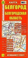
 | Belgorod - Oblast Belgorod Stadtplan 1:33.000 / Landkarte 1:530.000 - Russland Белгород - Белгородская область Rus Co. Ltd. |
 | T5242 Vittikko Topographische Karte 1:25.000 EUREF (Peruskartta) Maanmittauslaitos / Lantmäteriverket Finnland - ProjektNord |
 | 7336 Mainburg Topographische Landkarte Bayern 1:25.000 - Normalausgabe - ProjektNord (geplottete Ausgabe) - Grundlage amtliche Topographische Karte Bayern DTK25 |
 | S4323 Yli-Olhava Topographische Karte 1:25.000 EUREF (Peruskartta) Maanmittauslaitos / Lantmäteriverket Finnland - ProjektNord |
 | Q4434 Lämpsänneva Topographische Karte 1:25.000 EUREF (Peruskartta) Maanmittauslaitos / Lantmäteriverket Finnland - ProjektNord |
 | Rund um Betzdorf Topographische Wanderkarte Rheinland-Pfalz mit Wanderwegen und Radwegen 1:25.000 - ProjektNord |
 | Ortho NGI 1:25.000 Touristische Landkarte und Wanderkarte Belgien |
 | 6240 Flossenbürg Topographische Landkarte Bayern 1:25.000 - Normalausgabe - ProjektNord (geplottete Ausgabe) - Grundlage amtliche Topographische Karte Bayern DTK25 |
 | Thüringer Städtekette 1:50.000 (Gabi Weisheit) Radwanderweg - Mit Innenstadtplänen Grünes Herz |
 | Q4314 Parkkima Topographische Karte 1:25.000 EUREF (Peruskartta) Maanmittauslaitos / Lantmäteriverket Finnland - ProjektNord |
 | Central Coast Queensland - Straßenkarte Australien HEMA Maps |
 | L3316 Diepholz (geplottete Ausgabe) Topographische Karte 1:50.000 Kartografie Landesvermessungsamt Niedersachsen - ProjektNord |
 | N5424 Joensuu Topographische Karte 1:25.000 EUREF (Peruskartta) Maanmittauslaitos / Lantmäteriverket Finnland - ProjektNord |
 | Gaya Topographische Karte 1:25.000 Messtischblatt des Deutschen Reiches - Preußische Landesaufnahme / Reichsamt für Landesaufnahme - Faksimile ProjektNord |
 | 5626 Sandberg Topographische Landkarte Bayern 1:25.000 - Normalausgabe - ProjektNord (geplottete Ausgabe) - Grundlage amtliche Topographische Karte Bayern DTK25 |
 | 11 S. Mateus (Pico - Azoren) - Topographische Karte Portugal 1:25.000 Carta Militar de Portugal - Série M889 - 1/25 000 (Acores) - Instituto Geográfico do Exército (IGeoE) - Portugal |
 | Aquileia (Friaul) - ein Reiseführer mit Stadtplan Elena Commessatti - Libreria Editrice Odos - Italien |
 | Ostfriesische Nordseeküste, Westlicher Teil Rad- und Wanderkarte mit Ausflugszielen, Einkehr- & Freizeittipps, wetterfest, reissfest, abwischbar, GPS-genau. 1:50000 - von - Freytag-Berndt und ARTARIA Publicpress |
 | 5313 (NM 33-12-13) Hollabrunn Topographische Wanderkarte 1:50.000 mit Wegmarkierungen - Österreich - Kartographie BEV - ProjektNord |
 | N5142 Haukivesi Topographische Karte 1:25.000 EUREF (Peruskartta) Maanmittauslaitos / Lantmäteriverket Finnland - ProjektNord |