| << Russland: Städte, Stadtpläne, Stadtatlanten, Stadtführer << Russland: Oblaste und Regionen etc. << Rus Co. Ltd. |
||
|
||
Zuletzt angesehene Artikel:
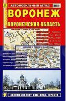
 | Woronesch - Oblast Woronesch Stadtatlas und StraÃenatlas 1:20.000 / 1:750.000 Voronesch - Voroneschskaja Oblast Rus Co. Ltd. - Russland |
 | Detaillierter Atlas von Moskau StraÃenatlas - Russland Москва. Самый подробный справочный атлас Russland |
 | 1318 Ockholm - Gestern und Heute - Historische Ãberlagerung 1902-1930 Topographische Landkarte 1:25.000 im Vergleich - Landesvermessungsamt Schleswig-Holstein / ProjektNord |
 | Woblast Minsk - StraÃenatlas 1:200.000 + Minsk Stadtplan + 24 Stadtpläne Minskaja Oblast Atlas Avtomobilnich Dorog + Karta Minska + 24 Karti Gorodov - TRIVIUM |
 | Jekaterinburg StraÃenatlas - Softcover Екатеринбург. Атлас автодорог Russland |
 | NL 32-02-30 Ost (1230-Ost) Schruns Ãsterreichische Karte 1:25.000 mit Wegmarkierungen (topographische Wanderkarte - UTM) - BEV - Ãsterreich - VergröÃerung (ÃK25V) |
 | Wladimir - Wladimirer Oblast Stadtatlas und StraÃenatlas 1:25.000 / 1:200.000 Wladimir - Wladimirskaja Oblast Rus Co. Ltd. - Russland |
 | Europa - Westeuropa - Baltische Staaten - WeiÃrussland - Ukraine - Moldau Autoatlas / StraÃenatlas - Russland Atlas awtomobilnych dorog. Ewropa. Sapadnaja Ewropa, strany Baltii, Belarus, Ukraina, Moldowa |
 | Atlas Moskau - mit Darstellung einzelner Häuser 1:12.000 / 1:6.000 Атлас - Москва AGT Geocenter Russland |
 | 6536 Sulzbach-Rosenberg Süd Topographische Landkarte Bayern 1:25.000 - Normalausgabe - ProjektNord (geplottete Ausgabe) - Grundlage amtliche Topographische Karte Bayern DTK25 |
 | Russland - GUS-Staaten und Baltikum (Hardcover) Autoaltas 1:200.000, 1:500.000, 1:1 Mio., 1:2.5 Mio., 1:5 Mio. Atlas avtodorog Rossii - stran SNG i Baltii (prigranitschnije rajone) - Russland |
| Oslofjorden - Færder - Hvaler - Halden - Seekarte Norwegische Küste 1:50.000 - (Blatt 1) Den Norske Kyst Sjøkart - Hovedkart (sjø) Statens Kartverk Sjø - Norwegen |
 | Sankt Petersburg StraÃenatlas 1:12.500 / 1:33.000 (A5) Санкт-Петербург Атлас Автодорог / Sankt Peterburg Atlas Awtodorog OOO Izdatelstwo Premiera - Russland |
 | 6535 Alfeld Topographische Landkarte Bayern 1:25.000 - Normalausgabe - ProjektNord (geplottete Ausgabe) - Grundlage amtliche Topographische Karte Bayern DTK25 |
 | 6328 Scheinfeld Topographische Landkarte Bayern 1:25.000 - Normalausgabe - ProjektNord (geplottete Ausgabe) - Grundlage amtliche Topographische Karte Bayern DTK25 |
 | UK 50-30 Naturpark Bayerischer Wald südl. Teil - Passau - Freyung - Deggendorf - Vilshofen Wanderkarte Bayern 1:50.000 mit Wanderwegen und Radwanderwegen, GPS-Gitter - Landesamt für Digitalisierung, Breitband und Vermessung (Landesvermessungsamt Bayern) |
 | 5634 Teuschnitz Topographische Landkarte Bayern 1:25.000 - Normalausgabe - ProjektNord (geplottete Ausgabe) - Grundlage amtliche Topographische Karte Bayern DTK25 |
 | 6436 Sulzbach-Rosenberg Nord Topographische Landkarte Bayern 1:25.000 - Normalausgabe - ProjektNord (geplottete Ausgabe) - Grundlage amtliche Topographische Karte Bayern DTK25 |
 | 6040 Neualbenreuth Topographische Landkarte Bayern 1:25.000 - Normalausgabe - ProjektNord (geplottete Ausgabe) - Grundlage amtliche Topographische Karte Bayern DTK25 |
 | 6041 Mähring Topographische Landkarte Bayern 1:25.000 - Normalausgabe - ProjektNord (geplottete Ausgabe) - Grundlage amtliche Topographische Karte Bayern DTK25 |