 Aktuelle Topographische Landkarte Spanien 1:25.000 im Regelblattschnitt der spanischen Vermessungsbehörde Centro Nacional de Informacion Geografica (CNIG) im Instituto Geografico Nacional de Espana (IGN). Die Karten werden auf Kundenbestellung gedruckt, daher keine Rücknahme bei Fehlbestellung. Durch die eigene Herstellung können wir eine schnelle Lieferzeit erreichen.  Gesamtliste mit Blattübersicht ProjektNord (Print on Demand) Gesamtliste mit Blattübersicht ProjektNord (Print on Demand)
Gesamtliste mit Blattübersicht (Druckausgabe CNIG) Topographische Landkarte 1:25.000 Spanien. Kartenbeispiel aus der Serie Kartenausschnitt
|
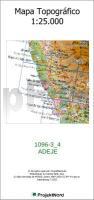
1096-3_4 ADEJE Topographische Landkarte 1:25.000 Spanien (Grundlage MTN25) Instituto Geográfico Nacional - CNIG Spanien - ProjektNord
Preis: EUR 19.90
|
| 
