| << Cookinseln - Tokelau-Inseln - Niue - Kermadecinseln |
||
|
||
Zuletzt angesehene Artikel:
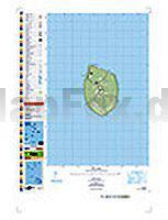
 | PI19 Mauke (Cookinseln) Topographische Landkarte 1:25.000 - Land Information New Zealand |
 | 1175 VÄTTIS 1:25.000 - Calfeisen - Pizol - Calanda - Topographische Landeskarte der Schweiz - swisstopo |
 | 160 Windsor - Weybridge & Bracknell - Wanderkarte Großbritannien 1:25.000 EXPLORER MAP - Ordnance Survey |
 | Tasmania North East 1:250.000 Topographic Map Topographische Landkarte Tasmanien - Australien - Tasmap (Tasmanien) |
 | 2734SB Craponne-sur-Arzon - Allègre - La Chaise-Dieu GPS Amtliche Topographische Wanderkarte Frankreich 1:25.000 - série bleue (IGN) |
 | 20 Dora Baltea Canavesana 1:25.000 Topographische Wanderkarte l`Escursionista Editore - Italien Carta dei sentieri della Dora Baltea Canavesana e dei Laghi d`Ivrea con guida |
 | 04 (P) Peak District & Derbyshire 1:100.000 - Touristische Karte TRAVEL MAP TOUR - Ordnance Survey - Großbritannien |
 | Tasmania South East 1:250.000 Topographic Map Topographische Landkarte Tasmanien - Australien - Tasmap (Tasmanien) |
 | Côte-d`Or - Saône-et-Loire Straßenkarte 1:150.000 Frankreich (Blatt 320) Michelin Départements |
 | NA503 Around Annapurna 1:125.000 Marsyangdi, Thorung Pass, Kali Gandaki - New Annapurna Trekking Trails updated to avoid the road - Nepa Maps Himalayan Maphouse Nepal |
 | Blatt 10B: Como - Rifugio Città di Lissone in Val Adamè 1:50.000 - Wanderkarte - Sentiero Italia Lombardia CAI - 4land / Idea Montagna Carta itineraria del Sentiero Italia tratto lombardo, da Como al Rifugio Città di Lissone in Val Adamè 4land / Idea Montagna |
 | Toskana Nord - Florenz - Apennin - Apuanische Alpen *** SCHNÄPPCHEN *** - Rother Wanderführer - Bergverlag Rother |
 | Mosel - Kylltal - Meulenwald Topographische Wanderkarte Rheinland-Pfalz mit Wanderwegen und Radwegen 1:25.000 - ProjektNord |
 | La collina Reggiana (Bassa) 1:25.000 - Foglio 1 Wanderkarte GEOMEDIA - Italien |
 | 3336OT LA MURE VALBONNAIS Topographische Wanderkarte Frankreich 1:25.000 TOP 25 IGN - (GPS) |
 | 205 Kos 1:60.000 Landkarte Griechische Inseln - Road Editions - Griechenland |
 | 033 Pustertal / Val Pusteria - Bruneck / Brunico Topographische Wanderkarte 1:25.000 - Casa Editrice Tabacco - Italien |
 | 21 Briançon - Vallée de la Guisane - Vallée de la Clarée (wasserfest) Topographische Wanderkarte und Straßenkarte 1:25.000 Fraternali Editore - Italien |
 | Vall de la Llosa, el Baridà (Blatt 55) 1:25.000 Andorra la Vella, Tossa Plana de Lles, Puigpedrós, la Batllia - Wanderkarte Katalonien (Spanien) - Col·lecció Unitats Geogràfiques - Institut Cartogràfic de Catalunya |
 | 046 Lana - Val d`Adige / Lana - Etschtal Topographische Wanderkarte 1:25.000 - Casa Editrice Tabacco - Italien |