| << Cookinseln - Tokelau-Inseln - Niue - Kermadecinseln |
||
|
||
Zuletzt angesehene Artikel:
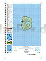
 | PI18 Mitiaro (Cookinseln) Topographische Landkarte 1:25.000 - Land Information New Zealand |
 | CF08 Topographische Landkarte Neuseeland 1:50.000 Land Information New Zealand |
 | 6324 Tauberbischofsheim Ost Topographische Landkarte 1:25.000 - Landesvermessungsamt Baden-Württemberg |
 | Wendland.Elbe-Kartenbundle: Radlerland - Wanderland - Rundlingskarte 3 Topographische Landkarten - Regionalmarketing Wendland |
 | Montalbano e Padule di Fucecchio 1:25.000 (MPF) Wanderkarte S.EL.CA - Italien (SELCA) |
 | 124 Nantes - St-Nazaire *** SCHNÄPPCHEN *** Topographische Touristische Landkarte Frankreich - carte de promenade 1:100.000 - IGN Frankreich |
 | 610 Svenska högarna - Terrängkartan 1:50.000 Topographische Wanderkarte Schweden - Lantmäteriet Landkarte Schweden |
| 6725 Gerabronn Topographische Landkarte 1:25.000 - Landesvermessungsamt Baden-Württemberg |
 | 18 Murchison Topographische Landkarte Neuseeland 1:250.000 Land Information New Zealand |
 | Picardie Straßenkarte Local 1:150.000 (Blatt 301) Michelin Frankreich |
 | L8314 Waldshut-Tiengen Topographische Landkarte 1:50.000 - Landesvermessungsamt Baden-Württemberg |
 | 6520 Waldbrunn Topographische Landkarte 1:25.000 - Landesvermessungsamt Baden-Württemberg |
 | 187 Llandovery / Llanymddyfri - Llanwrtyd Wells & Llyn Brianne - Wanderkarte Großbritannien 1:25.000 EXPLORER MAP - Ordnance Survey |
 | Gran Sasso Wanderführer (italienisch) SOCIETA EDITRICE RICERCHE (SER) - Italien |
 | La Palma Reiseführer Michael-Müller-Verlag - Reiseführer |
| 102.4 Amtliche topographische Karte 1:50.000 Polen |
 | PAS-DE-CALAIS - ARRAS - CALAIS - BÉTHUNE - BOULOGNE-SUR-MER - PNR DES CAPS ET MARAIS D`OPALE (Blatt D62) Département-Landkarte Frankreich 1:100.000 PAS-DE-CALAIS - Carte départementale - IGN Frankreich |
 | 141 Östhammar - Vägkartan 1:100.000 Topographische Karte Schweden - Lantmäteriet Landkarte Schweden, Straßenkarte |
 | 1624 Rendsburg Topographische Landkarte 1:25.000 Landesvermessungsamt Schleswig-Holstein |
 | Rhodos - mit Symi und Chalki 50 Touren - Rother Wanderführer - Bergverlag Rother |