| << Cookinseln - Tokelau-Inseln - Niue - Kermadecinseln |
||
|
||
Zuletzt angesehene Artikel:
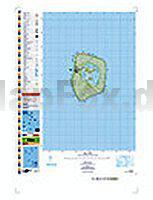
 | PI18 Mitiaro (Cookinseln) Topographische Landkarte 1:25.000 - Land Information New Zealand |
 | Alta Anoia Sud Copons, Rubió, Argençola - Wanderkarte 1:25.000 - Editorial Piolet - Spanien |
 | Probstei Topographische Wanderkarte mit Wanderwegen und Radwegen 1:25.000 Schleswig-Holstein - ProjektNord |
 | Lyon autour de à pied - Rhône-Alpes Wanderführer - (französisch) Chamina - Frankreich |
 | Bike map 3 - L`Alto Appennino Reggiano 1:25.000 MTB-Fahrradkarte GEOMEDIA - Italien |
 | 105B15 - Scurvy Creek Topographische Landkarte 1:50.000 - Canada - Yukon |
 | Great Himalayan Trail N9: Makalu Barun 1:100.000 - Trekkingmap Nepal - Newgrove Consultants |
 | Rendsburg - Wittensee Topographische Wanderkarte mit Wanderwegen und Radwegen 1:25.000 Schleswig-Holstein - ProjektNord |
 | Coast to Coast Challenge Map 1:40.000 Wanderkarte - Discovery Walking Guides Ltd Coast 2 Coast Super-Durable Challenge Map |
 | Afrika und die Welt - Schüler-Landkarte 1:10 Mio. und 1:50 Mio. Africa & The World Pack Student Map MapStudio |
 | Walking The Thames Path from London to the river`s source in Gloucestershire - Wanderführer Southern England - Cicerone GroÃbritannien (englisch) |
 | 03 Bergisch Gladbach 1:25.000 Königsforst - Lindlar - Overath Topographische Wanderkarte - GeoMap |
| 2722ET AVALLON-VEZELAY Topographische Wanderkarte Frankreich 1:25.000 TOP 25 IGN - (GPS) |
 | USA-West 1:3.5 Mio. Landkarte Hildebrand`s Urlaubskarten |
 | 047 Tobermory & North Mull - Wanderkarte GroÃbritannien 1:50.000 LANDRANGER MAP - Ordnance Survey |
 | Walking the Fife Pilgrim Way - Pilgrimage from Culross and North Queensferry to St Andrews Wanderführer - Cicerone (englisch) |
 | 1176 SCHIERS 1:25.000 - Landquart - Trimmis - Jenaz - Topographische Landeskarte der Schweiz - swisstopo |
| L-33-V Sopron Amtliche Topographische Landkarte Ungarn 1:200.000 |
 | 106D09 McClusky Lake Topographische Landkarte 1:50.000 - Canada - Yukon Territory |
| 106 S Trondheim SÃR 1:50.000 - Amtliche Topographische Landkarte Norwegen - Startens Kartverk |