| << Cookinseln - Tokelau-Inseln - Niue - Kermadecinseln |
||
|
||
Zuletzt angesehene Artikel:
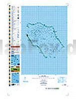
 | PI16 Penrhyn (Cookinseln) Topographische Landkarte 1:50.000 - Land Information New Zealand |
 | 250 Parco delle Colline di Brescia 1:25.000 - Topographische Wanderkarte - Italien - 4land |
 | 187 Anterselva e Casies / Antholz und Gsies 1:25.000 - Topographische Wanderkarte - Italien - 4land Carta topografica escursionistica di Anterselva e Casies |
 | Bretagne 1:200.000 Straßenkarte Frankreich - (Blatt 512) Michelin Regional |
 | 39 FLUELAPASS 1:100.000 - Arosa - Davos - Zernez - Scuol - Topographische Landeskarte der Schweiz - swisstopo |
 | Gorski kotar 2 - Nationalpark Risnjak mit Wanderwegen und Radwegen - Wanderkarte - Fahrradkarte 1:35.000 Kroatien - ProjektNord Gorski kotar 2 - Nacionalni park Risnjak ProjektNord |
 | USA North-East & Canada East Straßenkarte 1:2.4 Mio. (Blatt 583) Michelin Regional USA |
 | CK6: Lofoten, Vesterålen og Senja 1:410.000 Cappelens Kart - Straßenkarte und Touristenkarte Norwegen |
 | 1155 SARGANS 1:25.000 - Flums - Mels - Bad Ragaz - Topographische Landeskarte der Schweiz - swisstopo |
 | PI13 Manuae (Cookinseln) Topographische Landkarte 1:25.000 - Land Information New Zealand |
 | 31 Valpelline - Saint Barthélemy - Aosta-Valle Centrale 1:25.000 Topographische Wanderkarte und Straßenkarte 1:25.000 Fraternali Editore - Italien |
 | 273T MONTANA - Col du Sanetsch - Sion - Val d`Anniviers 1:50.000 Topographische Wanderkarte SAW der Schweiz - swisstopo |
 | 3540ET HAUTE VALLEE DU VAR Topographische Wanderkarte Frankreich 1:25.000 TOP 25 IGN - (GPS) |
 | 1648 Sellin Amtliche Topographische Karte 1:25.000 Landesvermessungsamt Mecklenburg-Vorpommern |
 | Commonwealth of Dominica 1:40.000 - Landkarte - Street map - GMP - Geographic Map Publishing - midok - Michal Kasprowsky |
 | AV30 Topographische Landkarte Neuseeland 1:50.000 Land Information New Zealand |
 | 282 MARTIGNY 1:50.000 - Chamonix - Orsières - Verbier - Topographische Landeskarte der Schweiz - swisstopo |
 | NA501 Annapurna Base Camp 1:50.000 - Annapurna Sanctuary Trekkingkarte - Himalayan MapHouse - Nepal |
 | 248 PRÄTTIGAU 1:50.000 Topographische Landeskarte der Schweiz - swisstopo |
 | Fürstenberg - Feldberg - Templin (wasserfest) Kartenset 3 Rad-, Wander- und Gewässerkarten 1:35.000 (Feldberger Seen / Fürstenberg - Havel - Lychen - Templin) - Grünes Herz |