| << Cookinseln - Tokelau-Inseln - Niue - Kermadecinseln |
||
|
||
Zuletzt angesehene Artikel:
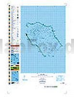
 | PI16 Penrhyn (Cookinseln) Topographische Landkarte 1:50.000 - Land Information New Zealand |
 | MARCO POLO Länderkarte Norwegen Süd 1:325.000 |
 | 3545-SO Topographische Karte 1:10.000 - Landesvermessungsamt Brandenburg |
 | Krakau laminierter Stadtplan 1:20.000 Kraków plan miasta Demart - Polen |
 | 105M12 Mayo - Yukon Territory Topographische Landkarte 1:50.000 - Canada - Yukon |
 | Thüringen Reiseführer mit vielen praktischen Tipps - von Heidi Schmitt - Michael-Müller-Verlag |
 | 336 Biggar & Broughton - Wanderkarte GroÃbritannien 1:25.000 EXPLORER MAP - Active Map LAMINIERT - Ordnance Survey |
 | Rund um Nürnberg Frankenalb - Frankenhöhe - Steigerwald - Fränkisches Seenland - von Heimler, GerhardSchmieg, Wolfgang - Bergverlag Rother |
 | Stille Pfade Allgäu Mit Kleinwalsertal und Tannheimer Tal. 37 einsame Wanderungen. Mit GPS-Daten - von Gerald Schwabe - Bergverlag Rother |
| 048 S Mongstad SÃR 1:50.000 - Amtliche Topographische Landkarte Norwegen - Startens Kartverk |
 | Exmoor Wanderkarte 1:25.000 Superwalker XT25 - HARVEY MAPS Exmoor Superwalker |
 | Ãgypten 1:1.3 Mio. Geographische Landkarte Egypt GiziMap |
 | Piemont Süd: Vom Monviso bis zu den Ligurischen Alpen 50 Touren - Rother Wanderführer - Bergverlag Rother |
 | 233 Slovensky Kras - Slovensky Raj - Slovenske Rudohorie vychod Touristische Landkarte Slowakei 1:100.000 Slovensky Kras - Slovensky Raj - Slovenske Rudohorie vychod - SHOCart |
 | Malaysia - Singapur - Brunei Nelles-Reiseführer Nelles-Verlag |
 | 2935OT LE CHAMBON-SUR-LIGNON - SAINT-AGREVE Topographische Wanderkarte Frankreich 1:25.000 TOP 25 IGN |
 | Belle-Ãle - per Rad und zu Fuà Inselkarte 1:30.000 - BELLE-ÃLE à vélo et à pied Collection Mini Cartes des Ãles - IGN - Frankreich |
 | Ostwestfalen ADFC-Regionalkarte 1:75.000 BVA Bielefelder Verlag |
 | 1111 ALBIS 1:25.000 Topographische Landeskarte der Schweiz - swisstopo |
 | Auvergne & Limousin - Zentralmassiv - von Severine Weber und Martin Müller - Michael-Müller-Verlag |