| << Cookinseln - Tokelau-Inseln - Niue - Kermadecinseln |
||
|
||
Zuletzt angesehene Artikel:
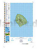
 | PI15 Atiu (Cookinseln) Topographische Landkarte 1:25.000 - Land Information New Zealand |
 | 125.22 Amtliche topographische Karte 1:25.000 Polen |
 | Lofoten 1:50.000 Turkart - Wanderkarte Norwegen - Calazo Förlag |
 | DUMONT Reise-Taschenbuch La Gomera von Lipps, Susanne u. Breda, Oliver |
 | 102 Land`s End - Wanderkarte GroÃbritannien 1:25.000 EXPLORER MAP - Active Map LAMINIERT - Ordnance Survey |
 | KOMPASS Radvergnügen Kärnten 21 1/2 Feierabend-Rides, Tagestouren & Wochenend-Bikeaways - von Arneitz, Anita - KOMPASS-Karten |
 | Toskana StraÃenkarte Local 1:200.000 (Blatt 358) Michelin Italien Toscana |
 | Coast to Coast Path (St. Bees to Robin Hood´s Bay) Wanderführer englisch - Trailblazer |
 | DuMont direkt Reiseführer Tokyo Mit groÃem Cityplan - von Rufus Arndt - DuMont Reiseverlag |
 | Wanderkarte Nationalpark Hainich - Biotop Wanderkarte - grünes herz |
| 105G02 - Fire Lake Topographische Landkarte 1:50.000 - Canada - Yukon |
 | 155 Val di Non 1:25.000 (Extra stabil und wasserfest) Wanderkarte - 4land |
| 234.11 Amtliche topographische Karte 1:25.000 Polen |
 | 101 London Geheimtipps und Top-Ziele - von Lilly Nielitz-Hart, Simon Hart - Iwanowski |
 | El Salvador The premier guidebook for Business Globetrotters (englisch) eBiz Guides |
 | Amsterdam & Niederlande 1:8.000 / 1:400.000 - Landkarte - ITMB International Travel Reference Maps (engl.) Amsterdam & Netherlands Travel Reference Map |
 | Sudak - Nowiy Swjet Stadtplan 1:8.000 / 1:16.000 Kartografija - ukrmap Ukraine |
 | Orkney - environment walks A map/guide to eight easy to follow walks - Footprint Maps - Stirling Surveys |
 | The Cumbria Coastal Way Wanderführer Lake District - Cicerone GroÃbritannien (englisch) |
 | Karlsruhe 2004 1:5.500/1:20.000 (Blatt 319) Bildstadtplan Bollmann-Bildkarten-Verlag |