| << Cookinseln - Tokelau-Inseln - Niue - Kermadecinseln |
||
|
||
Zuletzt angesehene Artikel:
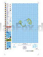
 | PI13 Manuae (Cookinseln) Topographische Landkarte 1:25.000 - Land Information New Zealand |
 | Menorca - Die schönsten Inselwanderungen 35 Touren Wanderführer - von Ulrich Redmann und Laura Aguilar - Bergverlag Rother |
 | 1023OT LA BAULE / LE CROISIC Topographische Wanderkarte Frankreich 1:25.000 TOP 25 IGN - (GPS) |
 | La Gomera 73 Touren - Die schönsten Küsten- und Bergwanderungen GPS - Rother Wanderführer - Bergverlag Rother |
 | L`alto sentiero 3 Wanderführer (italienisch) SOCIETA EDITRICE RICERCHE (SER) - Italien |
 | 357 Kintyre North - Wanderkarte GroÃbritannien 1:25.000 EXPLORER MAP - Active Map LAMINIERT - Ordnance Survey |
 | Discover Cairngorms National Park - Wanderkarte (wasserfest) Visitor Map - Footprint Maps - Stirling Surveys |
 | Oman Map & Guide 1:1.3 Mio. + verschiedene MaÃstäbe - Ministry of Tourism |
 | DuMont direkt Reiseführer Salzburg - DuMont Reiseverlag |
| 11-a Topographische Landkarte Georgien 1:50.000 Geoland Maps Georgien |
 | Europe road map 1:500.000-1.5 Mio StraÃenkarte - HarperCollins |
 | CR713 Tibet Trekking Guide 1:1.5 Mio. (mit Nepal, Bhutan und Sikkim) Road Distances - Trekking Routes - Monasteries - Introduction of Major Places - Himalayan MapHouse - Nepal |
 | 6014 Ingelheim am Rhein Topographische Karte 1:25.000 - Landesamt für Vermessung und Geobasisinformation Rheinland-Pfalz |
 | Northumberland Outstanding Circular Walks - Pathfinder 87- Englischsprachiger Wanderführer Jarrold Crimson Publishing |
 | Müritz - Land Fleesensee - Reiseführer von Jo Lüdemann - Grünes Herz |
| 50-a Topographische Landkarte Georgien 1:50.000 Geoland Maps Georgien |
 | Bremen mit Bremerhaven MM-City Reiseführer - von Sven Bremer - Michael Müller Verlag |
 | CityTrip Belfast Reiseführer mit Faltplan und kostenloser Web-App - von Astrid Fieà und Lars Kabel - Reise Know-How |
 | Alpinismo Piceno Wanderführer (italienisch) Club Alpino Italiano - ASCOLI PICENO - Italien |
 | US Rocky Mountains 1:1 Mio. Landkarte - ITMB International Travel Maps (engl.) |