| << Cookinseln - Tokelau-Inseln - Niue - Kermadecinseln |
||
|
||
Zuletzt angesehene Artikel:
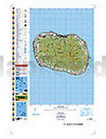
 | PI12 Rarotonga (Cookinseln) Topographische Landkarte 1:25.000 - Land Information New Zealand |
 | Le Vie del Sale (Blatt 7) - Il Novese e le Valli Scrivia, Borbera, Spinti e Lemme - Wanderkarte Italien 1:25.000 dal basso Piemonte al Mare - Topographische Wanderkarte Studio Cartografico Italiano - Italien |
 | Belgien Süd - Ardennen Regionale Straßenkarte 1:200.000 (Blatt 534) Michelin |
 | Namen / Namur 1:150.000 Straßenkarte Belgien (Blatt 378) Michelin Local |
 | M-34-60-A/B Tyszowce Amtliche topographische Landkarte Polen 1:50.000 M-34-60-A/B Tyszowce - Mapa Topograficzna Polski Glowny Geodeta Kraju |
 | Finnland Straßenkarte 1:1.2 Mio. Jana Seta Suomi Tiekartta |
 | Valea Ariesului de la Albac la Vartop 1:35.000 (Blatt 6) wasserfeste Karte, rumänisch - englisch Valea Arieşului de la Albac la Vârtop - Harta turistica / Tourist map Zenith - Rumänien |
 | Québec 1:1 Mio. Straßenkarte (Blatt 760) Michelin |
 | NE511 Makalu Base Camp (Everest) Trekkingkarte 1:80.000 Himalayan MapHouse - Nepal |
 | NL 32-06 Bozen 1:250.000 Bormio - Brixen - Bruneck - Meran - Sterzing - Trento - topographische Landkarte - BEV - Österreich |
 | 0/11 Langthang Himal Ost 1:50.000 - Trekkingkarte Alpenvereinskarte - DAV Deutscher Alpenverein |
 | 19 Saint-Hubert 1:25.000 - 710 km Wanderwege Touristische Landkarte und Wanderkarte, Radwanderkarte, Reitkarte - Mini Ardenne - Belgien |
 | 13 Haute-Sûre - Martelange 1:25.000 - 840 km Wanderwege Touristische Landkarte und Wanderkarte, Radwanderkarte, Reitkarte - Mini Ardenne - Belgien |
| BE40 Topographische Landkarte Neuseeland 1:50.000 Land Information New Zealand |
 | Argentinien: Bariloche - Siete Lagos 1:1 Mio. Touristische Landkarte /Straßenkarte Argentina: Bariloche/Siete Lagos - Regional Map DeDios Editores - Argentinien |
 | Oblast Woronesch 1:800.000 Straßenkarte / Regionalkarte - Russland Карта автодорог Воронежской области и прилегающих территорий Russland |
 | Tour de la Vallée de Cogne Gran Paradis (ital.) Wanderführer mit Karte 1:25.000 l`Escursionista Editore - Italien |
 | Valls (Blatt 36) 1:25.000 - Wanderkarte Katalonien (Spanien) - Col·lecció Capitals Comarcals - Institut Cartogràfic de Catalunya |
| BB32 Topographische Landkarte Neuseeland 1:50.000 Land Information New Zealand |
 | 4 Westhoek fietsnetwerk Fahrradkarte (wasserfest) 1:50.000 - Belgien Fietsnetwerk Belgien |