| << Cookinseln - Tokelau-Inseln - Niue - Kermadecinseln |
||
|
||
Zuletzt angesehene Artikel:
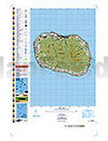
 | PI12 Rarotonga (Cookinseln) Topographische Landkarte 1:25.000 - Land Information New Zealand |
 | Mallorca - Süd 1:40.000 Wanderkarte Reise-Know-How Verlag |
 | Tulameen - TOPO (Blatt VCBC17) Topographische Landkarte - Backroad Topo Map Kanada |
| Essen 1989 (Blatt 241) Historischer Bildstadtplan Bollmann-Bildkarten-Verlag |
| 1343OT CAPBRETON Topographische Wanderkarte Frankreich 1:25.000 TOP 25 IGN |
| 081 S Rendalen - Sølen SÃR 1:50.000 - Amtliche Topographische Landkarte Norwegen - Startens Kartverk |
 | Kanchanjanga 1:100.000 - Trekking Map - Nepal Map Publisher Pvt. Ltd. |
 | Israel Reiseführer (englisch) Bradt Publications |
 | Rätoromanisch - Wort für Wort Kauderwelsch-Sprachführer (Band 197) Reise-Know-How Verlag |
| Essen 1969 (Blatt 89) Historischer Bildstadtplan Bollmann-Bildkarten-Verlag |
 | Summerlin und Spring Valley (Las Vegas) - Stadtplan - Rand McNally - USA |
 | Falk Stadtplan Extra Standardfaltung Hildesheim + Umgebungskarte |
 | Concise Atlas of Australia UBD Gregory`s Universal Publishers - Australien |
 | Norwegen Reiseführer Michael-Müller-Verlag - Reiseführer |
 | Albanien 1:220.000 Landkarte Reise-Know-How Verlag - world mapping project |
 | Dubai - UAE 1:14.000 / 1:700.000 - ITMB International Travel Reference Map |
 | Nationalpark Schwarzwald 40 Touren. Mit GPS-Tracks - von Martin Kuhnle - Bergverlag Rother |
 | Kraguevac Stadtplan 1:15.000 Merkur-SV Serbien |
 | Banja Luka Stadtplan 1:25.000 Merkur-SV Serbien |
 | Australien Ost 1:1.8 Mio. Landkarte Reise-Know-How Verlag - world mapping project |