| << Cookinseln - Tokelau-Inseln - Niue - Kermadecinseln |
||
|
||
Zuletzt angesehene Artikel:
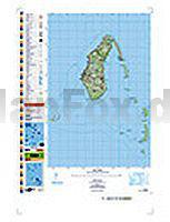
 | PI11 Aitutaki (Cookinseln) Topographische Landkarte 1:25.000 - Land Information New Zealand |
 | AT25 Topographische Landkarte Neuseeland 1:50.000 Land Information New Zealand |
| Fresno / Clovis / Hanford / Lemore Stadtplan 1:32.000 (Kalifornien - USA) Fresno / Clovis / Hanford / Lemore street map American Automobile Association |
 | 2105ET LE TOUQUET-PARIS-PLAGE / BERCK Topographische Wanderkarte Frankreich 1:25.000 TOP 25 IGN - (GPS) |
 | 39 FLUELAPASS 1:100.000 *** SCHNÄPPCHEN *** - Arosa - Davos - Zernez - Scuol - Topographische Landeskarte der Schweiz - swisstopo |
 | Kozani (Blatt 178) Präfektur Landkarte 1:200.000 Κοζάνη Orama - Griechenland |
| 3032SB Vénissieux - Oullins - Givors GPS Amtliche Topographische Wanderkarte Frankreich 1:25.000 - série bleue (IGN) |
 | 16 Valchiusella - Valle Sacra Trekking 1:25.000 (wasserfest) Topographische Wanderkarte l`Escursionista Editore - Italien |
| 2346SB Limoux - Cazilhac GPS Amtliche Topographische Wanderkarte Frankreich 1:25.000 - série bleue (IGN) |
| 2034SB Objat - Hautefort GPS Amtliche Topographische Wanderkarte Frankreich 1:25.000 - série bleue (IGN) |
 | 56 Südliches Harzvorland - mit Kyffhäuser, Goldene Aue und Hainleite Topographische Karte Thüringen 1:50.000 - Thüringer Landesvermessungsamt - Wanderkarte |
 | 256T DISENTIS / MUSTER - Oberalp - Val Medel - Surselva - Greina 1:50.000 Topographische Wanderkarte SAW der Schweiz - swisstopo |
 | Golf von Neapel - Halbinsel Sorrent, Pompei - Vesuv Landkarte 1:150.000 - (Blatt 901) Golfo di Napoli - Peninsola Sorrentina - Pompei - Vesuvio - Carta turistica e stradale Edizioni Multigraphic - Italien |
 | 34 Langhe Sud 1:25.000 (wasserfest) Topographische Wanderkarte und Straßenkarte 1:25.000 Fraternali Editore - Italien |
 | 294 GRESSONEY 1:50.000 - Champoluc - Corno Bianco - Scopello - Topographische Landeskarte der Schweiz - swisstopo |
 | 1373 MENDRISIO 1:25.000 - Varese - Stabio - Chiasso - Topographische Landeskarte der Schweiz - swisstopo |
 | PI16 Penrhyn (Cookinseln) Topographische Landkarte 1:50.000 - Land Information New Zealand |
 | 250 Parco delle Colline di Brescia 1:25.000 - Topographische Wanderkarte - Italien - 4land |
 | 187 Anterselva e Casies / Antholz und Gsies 1:25.000 - Topographische Wanderkarte - Italien - 4land Carta topografica escursionistica di Anterselva e Casies |
 | Bretagne 1:200.000 Straßenkarte Frankreich - (Blatt 512) Michelin Regional |