| << Cookinseln - Tokelau-Inseln - Niue - Kermadecinseln |
||
|
||
Zuletzt angesehene Artikel:
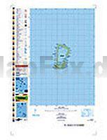
 | PI09 Rakahanga (Cookinseln) Topographische Landkarte 1:25.000 - Land Information New Zealand |
 | Blatt 9A: Sant`Antonio in Val Vogna - Formazza 1:50.000 - Wanderkarte - Sentiero Italia Piemonte CAI - 4land / Idea Montagna Carta itineraria del Sentiero Italia tratto piemontese, da Sant`Antonio in Val Vogna a Formazza 4land / Idea Montagna |
 | 1270 BINNTAL 1:25.000 - Bellwald - Ofenhorn - Griespass - Topographische Landeskarte der Schweiz - swisstopo |
 | Sentiero delle Orobie Occidentali (Foglio 1) 1:25.000 Ingenia Editori - Wanderkarte - Italien |
 | 2 Alta Valle Susa - Alta Val Chisone (GPS-tauglich) Topographische Wanderkarte und Straßenkarte 1:25.000 Fraternali Editore - Italien |
 | Reggio in bici 7 1:25.000 MTB-Fahrradkarte GEOMEDIA - Italien |
 | Finistère - Morbihan Straßenkarte 1:150.000 Frankreich (Blatt 308) Michelin Départements |
 | 24 Valle Orco Gran Paradiso (wasserfest) Topographische Wanderkarte und Straßenkarte 1:25.000 Fraternali Editore - Italien |
 | 248 Bourne & Heckington - Wanderkarte Großbritannien 1:25.000 EXPLORER MAP - Ordnance Survey |
 | 7: Parque Nacional Cerro Castillo - Patagonia - Chile 1:60.000 (wasserfest) Trekkingkarte - Andes-handbook - Chile |
 | 431 Thermenregion Innviertel - Ibmer Moor - Kobernaußerwald - Braunau - Burghausen - Marktl 1:50.000 - Wanderkarte / Radwanderkarte Österreich - GPS - Freytag & Berndt |
 | Sandomir - Stalowa Wola - Tarnobrzeg - Mielec Stadtplan plus 3 1:20.000 Sandomierz Stalowa Wola Tarnobrzeg plan miasta Demart - Polen |
 | W265 Lörrach - Wanderkarte 1:25.000 Hochheim (West), Bad Säckingen - von LGL - Landesamt für Geoinformation und Landentwicklung Baden-Württemberg (LGL) |
 | USA politisch Antik - große Ausgabe Laminierte PLANO-Karte 1:2.815 Mio. (Format: 176 x 122 cm) - gerollt im Plastikrohr USA political antique enlarged flat map - laminated National Geographic |
 | Lago Maggiore - Lago di Varese (Blatt 90) 4in1 Wanderkarte 1:50.000 mit Aktiv Guide und Detailkarten inklusive Karte zur offline Verwendung in der KOMPASS-App. Fahrradfahren. Skitouren. - von KOMPASS-Karten |
 | 5152 Raumberg Amtliche Topographische Landkarte 1:25.000 (Präsentationsgrafik) - Landesvermessungsamt Sachsen |
| 355.42 Amtliche topographische Karte 1:25.000 Polen |
| 422.1 Amtliche topographische Karte 1:50.000 Polen |
 | Val di Sole - Val di Rabbi - Val di Pèjo - Val Vermiglio - Val di Bresimo - Maddalene - Presanella - Cevedale - Brenta Settore Settentrionale - Wanderkarte und Mountainbike-Karte 1:25.000 GPS (Blatt 17) Carta Escursionistica e Mountainbike Casa Editrice Lagiralpina - Italien |
 | S. C. de Bariloche y Villa la Angostura 1:125.000 Mapa Topografico (Argentina) - Aonek´er MERIDIES - Argentinien |