| << Cookinseln - Tokelau-Inseln - Niue - Kermadecinseln |
||
|
||
Zuletzt angesehene Artikel:
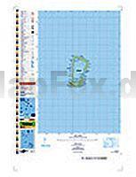
 | PI09 Rakahanga (Cookinseln) Topographische Landkarte 1:25.000 - Land Information New Zealand |
 | Das ScheiÃleben meines Vaters - das ScheiÃleben meiner Mutter und meine eigene ScheiÃjugend - von Andreas Altmann - Piper |
 | Potsdam - Panoramakarte & Stadtplan 1:17.000 - Terra Nostra |
 | Peak District - Park Rangers Favourite Walks (englisch) - Wanderführer National Parks - Collins - HarperCollins Publishers |
 | Fuerteventura StraÃenkarte Berndtson |
 | Torridon XT40 - Wanderkarte 1:40.000 ultra harvey - HARVEY MAPS |
 | Wanderungen in Sachsen von Wilfried Heinrich - Oberlausitzer Verlag |
 | Estonia, Latvia & Lithuania Reiseführer Lonely Planet (engl.) |
 | Jangtse Flusskarte und Führer - China Yangzi River Map & Guide Odyssey Publications |
 | Die schönsten Routen durch Südnorwegen - Wohnmobil-Tourguide Wohnmobil-Tourguides Reise-Know-How Verlag |
 | SENDA PIRENAICA - GR11 1:50.000 Wanderkarten mit Wanderführer - Spanien ALPINA |
 | Benevento Stadtplan 1:6.500 Benevento - Pianta della Citta L.A.C. GlobalMap Italien |
 | Spanien - Portugal 1:900.000 Landkarte Reise-Know-How Verlag - world mapping project |
 | Lodz Stadtplan 1:21.000 ŁÃ³dź plan miasta Demart - Polen |
 | Indigenous Peoples Trail (Nepal) Trekkingkarte 1:75.000 (NS508) Himalayan MapHouse - Nepal |
 | Lonely Planet Reiseführer San Francisco MAIRDUMONT |
 | Riviera di Ponente da Imperia a Mentone - Alpi Marittime e Liguri - Topographische Wanderkarte 1:25.000 (Blatt 111-112) Carta dei Sentieri e Rifugi - Edizioni Multigraphic - Italien |
 | Landauf, landab durch den Chianti classico - Reiseführer mit Wanderkarte - Edizioni Multigraphic - Italien |
 | Eccentric Cambridge Reiseführer (englisch) Bradt Publications |
 | DuMont direkt Reiseführer Norderney - DuMont Reiseverlag |