| << Cookinseln - Tokelau-Inseln - Niue - Kermadecinseln |
||
|
||
Zuletzt angesehene Artikel:
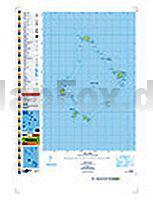
 | PI07 Palmerston (Cookinseln) Topographische Landkarte 1:25.000 - Land Information New Zealand |
 | AX33 Topographische Landkarte Neuseeland 1:50.000 Land Information New Zealand |
 | Franziskusweg - Von Florenz nach La Verna - 1:25.000 italienischer Wanderführer mit Wanderkarten Via di Francesco da Firenze a La Verna guide + carta 1:25.000 - Grillo S., Pezzani C. l`Escursionista Editore - Italien |
 | Australien - Neuseeland 1:6 Mio. AUSTRALIA - NEW ZEALAND - Internationale Landkarte - Cartographia |
 | TH03 Montagu River 1:50.000 Topographische Landkarte Tasmanien - Australien - Tasmap (Tasmanien) |
 | TP06 Denison Range 1:50.000 Topographische Landkarte Tasmanien - Australien - Tasmap (Tasmanien) |
 | 269 BERNINAPASS 1:50.000 Topographische Landeskarte der Schweiz - swisstopo Passo del Bernina |
 | Trisuli River - Rafting and Kayaking 1:150.000 Himalayan MapHouse - Nepal |
 | 1085 ST URSANNE 1:25.000 - Porrentruy - Glovelier - Col des Rangiers - Topographische Landeskarte der Schweiz - swisstopo |
| AV26 Topographische Landkarte Neuseeland 1:50.000 Land Information New Zealand |
| 1935SB Vergt - St-Pierre-de-Chignac - Thenon - GPS Amtliche Topographische Wanderkarte Frankreich 1:25.000 - série bleue (IGN) |
 | 01 Alta Valle Camonica - Tonale 1:25.000 - Valle Camonica - La Valle dei Segni - Wanderkarte - Ingenia Editori - Italien |
| TH04 The Nut 1:50.000 Topographische Landkarte Tasmanien - Australien - Tasmap (Tasmanien) |
 | 265T NUFENENPASS - Goms - Val Bedretto - Valle Maggia - Val Formazza (I) 1:50.000 Topographische Wanderkarte SAW der Schweiz - swisstopo |
 | 223 DELEMONT 1:50.000 - Moutier - Weissenstein - Laufen - Topographische Landeskarte der Schweiz - swisstopo |
| N-33-108-C/D Naklo n/Notecia Amtliche topographische Landkarte Polen 1:50.000 N-33-108-C/D Naklo n/Notecia - Mapa Topograficzna Polski Glowny Geodeta Kraju |
| 2 Hadersleben (Haderslev) - Kolding - du Platsche Karte 1804-1805 Topographische Karte des Herzogtums Schleswig - Reproduktion 1:100.000 |
 | ARDENNES - CHARLEVILLE-MÉZIÈRE - SEDAN - PNR DES ARDENNES (Blatt D08) Département-Landkarte Frankreich 1:100.000 ARDENNES - Carte départementale - IGN Frankreich |
 | Glatzer Grenzland Süd (Blatt 112) Topographische Wanderkarte 1:25.000 EUROKART (tschechisch) Kladské pomezí Geodezie On Line - Tschechien |
 | 26 Västervik 1:50.000 (wasserfest) Topographische Wanderkarte - Sverigeserien Topo50 - Schweden Kartförlaget |