| << Cookinseln - Tokelau-Inseln - Niue - Kermadecinseln |
||
|
||
Zuletzt angesehene Artikel:
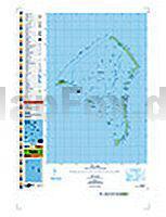
 | PI03 Fakaofo (Tokelau-Inseln) Topographische Landkarte 1:25.000 - Land Information New Zealand |
 | 109 Manchester - Bolton & Warrington - Wanderkarte Großbritannien 1:50.000 LANDRANGER MAP - Ordnance Survey |
 | 5151 Gr. Winterberg-Tetschen (104) - Geologische Karte 1:25.000 (GK25) Grundlage Vollbornsche Äquidistantenkarte Sächsisches Landesamt für Umwelt, Landwirtschaft und Geologie |
 | Kärnten, Nördliche Adria 1:200.000 Auto- + Freizeitkarte Carintia, Mar de Adriatic del norte Karinthie, Noord-Adriatische Zee - Carinthia freytag & berndt |
 | Tessin Panoramakarte Schweiz Hallwag Verlag |
 | Nordraum Leipzig, Leipziger Neuseenland - Radwander- und Wanderkarte 1:50.000 (Nr. 029) Ausflüge zwischen Leipzig, Delitzsch, Bad Düben. Zörbig und der Goitzsche bei Bitterfeld-Wolfen. Radwander- und Wanderkarte, Radtourenvorschläge mit Entfernungsangaben. Viele Tipps zu Sehenswürdigkeiten. GPS-fähig Dr. Barthel Verlag |
 | 39-557 Untermosel - Koblenz 1:25.000 - Wanderkarte mit Radwegen - NaturNavi |
| Walaam / Valamo 1:45.000 - 1:15.000 Touristische Wanderkarte - Russland Karta LTD Sankt Petersburg |
 | Fahrradkarte Neubrandenburg - Müritz - Feldberger Seen 1:75.000 - Grünes Herz |
 | Riesengebirge Wanderkarte Polen 1:50.000 Karkonosze - EKO-GRAF Polen |
 | Mendoza Provinz - Weinstraßen Landkarte mit Kurzreiseführer Mendoza - Rutas del Vino - Guía Mapa DeDios Editores |
| L7314 Baden-Baden Topographische Landkarte 1:50.000 - Landesvermessungsamt Baden-Württemberg |
 | Freizeitkarte Schorfheide - Barnim - Oderbruch 1:100.000 - Grünes Herz |
| M-34-51-A/B Myszkow Amtliche topographische Landkarte Polen 1:50.000 M-34-51-A/B Myszków - Mapa Topograficzna Polski Glowny Geodeta Kraju |
| 511.42 Amtliche topographische Karte 1:25.000 Polen |
| 6925 Obersontheim Topographische Landkarte 1:25.000 - Landesvermessungsamt Baden-Württemberg |
 | Sion - Nendaz - Verbier - Val de Bagnes - Val d`Heremence, Val d`Hérens (Blatt 26) 1:50.000 Topographische Skitourenkarte der Schweiz - SNOW TRAIL MAP |
 | 0620ET QUIMPERLE/PONT-AVEN Topographische Wanderkarte Frankreich 1:25.000 TOP 25 IGN - (GPS) |
 | Chile & Argentinien mit Osterinsel - Straßenatlas 1:1.25 Mio. / 1:2.2 Mio / 1:38.000 / 1:750.000 - ITMB International Travel Atlas (engl.) Chile and Argentina including Easter Island |
 | Vlaamse Ardennen koplopen 5 thematische wandelingen Wanderkarte - Belgien Wandelnetwerk Belgien |