(Titelbild evtl. abweichend)
 Leichte Druckfehler in der Schrift, daher zum Sonderpreis. Die Karte ist jedoch voll einsatzfähig. Hochwertige topographische Karte der Niederlande.  Blattschnitte Blattschnitte
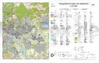
Kartenbeispiel aus der Serie Wir liefern bei Bedarf alle Blätter der Serie. Hinweis: Diese Karte wird individuell auf Kundenbestellung gedruckt und ist daher von der Rückgabe ausgeschlossen. Klicken Sie hier, wenn Sie diesen Artikel in der Version zum normalen Preis sehen möchten. Kartenausschnitt
|
40B ARNHEM *** SCHNÄPPCHEN *** Topographische Karte der Niederlande 1:25.000 (Plotausgabe)
40B ARNHEM Topografische Kaart van Nederland Kadaster - ProjektNord
Preis: EUR 9.95
|
| 


