| << Schweiz: Fahrradkarten, MTB-Karten und Radwanderführer - Kümmerly & Frey / Hallwag << Kümmerly & Frey |
  | |
Zuletzt angesehene Artikel:
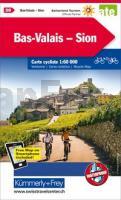
![]() | 20 Bas-Valais - Sion - Radwanderkarte 1:60.000 (wasserfest) Kümmerly & Frey |
![]() | L524 Ylämaa Topographische Karte 1:50.000 EUREF-FIN (Maastokarttat) Maanmittauslaitos / Lantmäteriverket Finnland - ProjektNord |
![]() | 181 Esterrid Aneu Amtliche topographische Landkarte 1:50.000 Spanien (M.T.N.) 181 Mapa Topográfico Nacional de Espana (MTN50) Instituto Geográfico Nacional - CNIG Spanien |
![]() | Salzalpensteig Chiemsee - Königssee - Hallstätter See. Alle Etappen. Mit GPS-Daten - von Renate Florl - Bergverlag Rother |
![]() | 22-323 Topographische Karte 1:25.000 der Tschechischen Republik Zakladní mapa Ceská republika Cesky urad zememericky a katastralni - ProjektNord |
![]() | 244 (25-11) Alfaro Amtliche topographische Landkarte 1:50.000 Spanien (M.T.N.) 244 Mapa Topográfico Nacional de Espana (MTN50) Instituto Geográfico Nacional - CNIG Spanien |
![]() | 2587 Gardienen Topographische Karte 1:25.000 Messtischblatt des Deutschen Reiches - Preußische Landesaufnahme / Reichsamt für Landesaufnahme - Faksimile ProjektNord |
![]() | 149 S Steigen SØR 1:50.000 - Amtliche Topographische Landkarte Norwegen - Startens Kartverk |
![]() | 156 Hronska pahorkatina - Nove Zamky Wanderkarte Slowakei 1:50.000 - VKU |
![]() | 244.21 Amtliche topographische Karte 1:25.000 Polen |
![]() | Jura Neuchâtelois - La Chaux de Fonds - Morteau - Neuchâtel - Couvet (Blatt 29) 1:50.000 Topographische Skitourenkarte der Schweiz - SNOW TRAIL MAP |
![]() | N-33-71-A/B Bytow Amtliche topographische Landkarte Polen 1:50.000 N-33-71-A/B Bytow - Mapa Topograficzna Polski Glowny Geodeta Kraju |
![]() | Skarverennet Wanderkarte Norwegen 1:50.000 (Blatt 2703) - Nordeca / UGLAND / Statens Kartverk Norwegen |
![]() | 22-411 Topographische Karte 1:25.000 der Tschechischen Republik Zakladní mapa Ceská republika Cesky urad zememericky a katastralni - ProjektNord |
![]() | NS517 Hidden Himalaya - Humlu & Mugu 1:90.000 Trekkingkarte - Himalayan MapHouse - Nepal |
![]() | Tschechien - Administrative Karte 1:500.000 Cesko - Administrativni mapa - kraje a okresy ZES Brno |
![]() | POLEN - Autokarte mit deutschen und polnischen Ortsnamen Straßenkarte 1:650.000 - PLAN galileos - Polen PLAN Galileos - Polen |
![]() | 08C FINSTERWOLDE Topographische Karte der Niederlande 1:25.000 (Plotausgabe) 08C FINSTERWOLDE Topografische Kaart van Nederland Kadaster - ProjektNord |
![]() | Bologna Stadtplan 1:14.000 Bologna - Pianta della Citta L.A.C. GlobalMap Italien |
![]() | N-33-117/118 Chodziez (Colmar) Plot aus der Kartengrundlage der amtliche topographische Karte Polen 1:100.000 ProjektNord |


