| << Portugal: Amtliche topografische Landkarten des Instituto GeogrÃĄfico do ExÃĐrcito (IGeoE) 1:25.000 (Serie M888) |
||
|
||

Zuletzt angesehene Artikel:
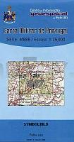
 | 597 Querenca (LoulÃĐ) Topographische Landkarte Portugal 1:25.000 Carta Militar de Portugal - SÃĐrie M888 Instituto GeogrÃĄfico do ExÃĐrcito (IGeoE) - Portugal |
 | 1224 SÃķrup - Gestern und Heute - Historische Ãberlagerung 1878-1880 Topographische Landkarte 1:25.000 im Vergleich - Landesvermessungsamt Schleswig-Holstein / ProjektNord |
 | 5923 Rieneck Topographische Landkarte Bayern 1:25.000 - Normalausgabe - ProjektNord (geplottete Ausgabe) - Grundlage amtliche Topographische Karte Bayern DTK25 |
 | Mosel - Ferienregion Schweich an der RÃķmischen WeinstraÃe mit Meulenwald (Blatt 30) 1:25.000 inkl. Moselsteig-Etappen, Moselsteig-SeitensprÞngen & Mountainbikerouten : Mosel Weinkulturland - Eifelverein e.V. |
 | Valli Giudicarie - Val di Daone - Val di Breguzzo - Val di Saviore - Wanderkarte und Mountainbike-Karte 1:25.000 GPS (Blatt 19) 19 Valli Giudicarie - Val di Daone - Carta Escursionistica e Mountainbike Casa Editrice Lagiralpina - Italien |
 | Konya - Karaman - Ereğli - Topographische Reisekarte 1:250.000 TÞrkei (Blatt 20) mit Wanderwegen - Landkarte Konya - Karaman - Ereğli ProjektNord |
 | 2021 Burg (Dithmarschen) - Gestern und Heute - Historische Ãberlagerung 1878-1880 Topographische Landkarte 1:25.000 im Vergleich - Landesvermessungsamt Schleswig-Holstein / ProjektNord |
| 2225 Quickborn - Gestern und Heute - Historische Ãberlagerung 1878-1880 Topographische Landkarte 1:25.000 im Vergleich - Landesvermessungsamt Schleswig-Holstein / ProjektNord |
| 1124 Westerholz - Gestern und Heute - Historische Ãberlagerung 1878-1880 Topographische Landkarte 1:25.000 im Vergleich - Landesvermessungsamt Schleswig-Holstein / ProjektNord |
 | 2 Valença - Topographische Landkarte - Wanderkarte und Fahrradkarte Portugal 1:25.000 002 Mapa topogrÃĄfico - Mapa de caminhadas - Portugal 1:25.000 ProjektNord |
 | 201 Parco Nazionale Arcipelago Toscano 1:25.000/1:15.000(extra wasser- und reiÃfest) *** SCHNÃPPCHEN *** Wander-und Mountainbikekartenset - 4land |
| 1215 HÃķrnum (Sylt) - Gestern und Heute - Historische Ãberlagerung 1878-1880 Topographische Landkarte 1:25.000 im Vergleich - Landesvermessungsamt Schleswig-Holstein / ProjektNord |
 | Hocheifel - NÞrburgring - Oberes Ahrtal - Topographische Wanderkarte 1:25.000 (Blatt 11) Offizielle Wanderkarte des Eifelvereins - Kartengrundlage Landesvermessungsamt Rheinland-Pfalz |
 | Wotschwien See 1:15.000 Touristische Wanderkarte, Wassersportkarte mit Tiefenprofilen - Polen Jezioro Woświn - mapa batymetryczna GPS 3D EKO-Map - Polen |
 | NM 33-10-12 West (3312-West) Wegscheid Ãsterreichische Karte 1:25.000 mit Wegmarkierungen (topographische Wanderkarte - UTM) - BEV - Ãsterreich - VergrÃķÃerung (ÃK25V) |
 | Berg und Uferwanderungen Salzkammergut - WanderfÞhrer 60 Touren von 2-4 Stunden mit Hinweis auf Familien- bzw. Rollstuhltauglichkeit - von Werner Mittermeier - Plenk-Verlag |
| 1723 WesterrÃķnfeld - Gestern und Heute - Historische Ãberlagerung 1878-1880 Topographische Landkarte 1:25.000 im Vergleich - Landesvermessungsamt Schleswig-Holstein / ProjektNord |
 | L5504 Schleiden (geplottete Ausgabe) Amtliche topographische Karte 1:50.000 Landesvermessungsamt Nordrhein-Westfalen |
 | Mystische PyrenÃĪen-PÃĪsse per Rad - vom Mittelmeer zum Atlantik RadwanderfÞhrer mit 7 Radwanderkarten - von Pere GÃģmez Puertos Miticos del Pirineo en bicicleta (Guia + 7 Mapas) - La gran travesÃa cicloturista del MediterrÃĄneo al AtlÃĄntico Spanien ALPINA |
 | 5118 Marburg - Wanderkarte mit Wanderwegen (geplottete Ausgabe) Topographische Landkarte Hessen 1:25.000 - ProjektNord (geplottete Ausgabe) |