Willkommen bei MapFox
Wurde Ihre Bestellung bestätigt? Wenn nicht - gab es evtl. ein SERVER-Problem! Bitte kontaktieren Sie uns! +++ Buchhändler-Anfragen erwünscht +++
Warenkorb
Artikel: 0 - € 0.00
Zur Kasse
Impressum Kontakt Versandkosten AGB
590 Alcarias (Alcoutim) Topographische Landkarte Portugal 1:25.000 Carta Militar de Portugal - Série M888 Instituto Geográfico do Exército (IGeoE) - Portugal
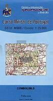
<< Portugal: Amtliche topografische Landkarten des Instituto Geográfico do Exército (IGeoE) 1:25.000 (Serie M888)
 
Cover

Gesamtliste mit Blattübersicht

Kartenbeispiel aus der Serie

Kartenausschnitt

590 Alcarias (Alcoutim) Topographische Landkarte Portugal 1:25.000 Carta Militar de Portugal - Série M888 Instituto Geográfico do Exército (IGeoE) - Portugal
EAN / ISBN: 9789727654970
Preis: EUR 17.90

Bestellartikel: versandfertig in ca. 2 Wochen oder länger. Dieser Artikel wird speziell für Sie bestellt. Keine Rücknahme!
Produkt EUR Anzahl Bestellen
590 Alcarias (Alcoutim) Topographische Landkarte Portugal 1:25.000 Carta Militar de Portugal - Série M888 Instituto Geográfico do Exército (IGeoE) - Portugal 17.90
Versandkostenfrei in Deutschland ab 30,- Bestellwert

incl. MwSt.

Stichworte, die bei der Suche nützlich sein könnten:
Alcoutim - Alcarias (Alcoutim) - Portugal - topografische Wanderkarten - Serie M888 - Série M888 - M888

Zuletzt angesehene Artikel:

Cover590 Alcarias (Alcoutim) Topographische Landkarte Portugal 1:25.000 Carta Militar de Portugal - Série M888 Instituto Geográfico do Exército (IGeoE) - Portugal

Cover503 Topographische Landkarte Wanderkarte und Fahrradkarte Portugal 1:25.000
503 Mapa topográfico - Mapa de caminhadas - Portugal 1:25.000 ProjektNord

Cover248-A Topographische Landkarte Wanderkarte und Fahrradkarte Portugal 1:25.000
248A Mapa topográfico - Mapa de caminhadas - Portugal 1:25.000 ProjektNord

Cover0351-4 SIERRA DE TORANZO Topographische Landkarte 1:25.000 Spanien (Grundlage MTN25) Instituto Geográfico Nacional - CNIG Spanien - ProjektNord

Cover1078B1_A1 PEÑÓN DE VÉLEZ DE LA GOMERA Topographische Landkarte 1:25.000 Spanien (Grundlage MTN25) Instituto Geográfico Nacional - CNIG Spanien - ProjektNord

Noch kein Cover vorhanden2526 Hamburg - Allermöhe - Gestern und Heute - Historische Überlagerung 1932-1950 Topographische Landkarte 1:25.000 im Vergleich - Landesvermessungsamt Schleswig-Holstein / ProjektNord

Cover395 Topographische Landkarte Wanderkarte und Fahrradkarte Portugal 1:25.000
395 Mapa topográfico - Mapa de caminhadas - Portugal 1:25.000 ProjektNord

Cover447 Topographische Landkarte Wanderkarte und Fahrradkarte Portugal 1:25.000
447 Mapa topográfico - Mapa de caminhadas - Portugal 1:25.000 ProjektNord

Cover223 Louriga (Seia) Topographische Landkarte Wanderkarte und Fahrradkarte 1:25.000
223 Mapa topográfico - Mapa de caminhadas - Portugal 1:25.000 ProjektNord

Cover483 Topographische Landkarte Wanderkarte und Fahrradkarte Portugal 1:25.000
483 Mapa topográfico - Mapa de caminhadas - Portugal 1:25.000 ProjektNord

Cover226 Topographische Landkarte Wanderkarte und Fahrradkarte Portugal 1:25.000
226 Mapa topográfico - Mapa de caminhadas - Portugal 1:25.000 ProjektNord

Cover1091-IV (Tenerife) La Montañeta Amtliche topographische Landkarte 1:25.000 Spanien (M.T.N.)
1091-IV Mapa Topográfico Nacional de Espana (MTN25) Instituto Geográfico Nacional - CNIG Spanien

Cover153 Topographische Landkarte Wanderkarte und Fahrradkarte Portugal 1:25.000
153 Mapa topográfico - Mapa de caminhadas - Portugal 1:25.000 ProjektNord

Cover485 Topographische Landkarte Wanderkarte und Fahrradkarte Portugal 1:25.000
485 Mapa topográfico - Mapa de caminhadas - Portugal 1:25.000 ProjektNord

Cover402 Topographische Landkarte Wanderkarte und Fahrradkarte Portugal 1:25.000
402 Mapa topográfico - Mapa de caminhadas - Portugal 1:25.000 ProjektNord

Cover516 Santiago Do Cacem Topographische Landkarte Wanderkarte und Fahrradkarte Portugal 1:25.000
516 Mapa topográfico - Mapa de caminhadas - Portugal 1:25.000 ProjektNord

Cover592 Bordeira (Aljezur) Topographische Landkarte Portugal 1:25.000 Carta Militar de Portugal - Série M888 Instituto Geográfico do Exército (IGeoE) - Portugal

Cover574 Gious (Alcoutim) Topographische Landkarte Wanderkarte und Fahrradkarte Portugal 1:25.000
574 Mapa topográfico - Mapa de caminhadas - Portugal 1:25.000 ProjektNord

Cover583-A Praia da Arrifana (Aljezur) Topographische Landkarte Portugal 1:25.000 Carta Militar de Portugal - Série M888 Instituto Geográfico do Exército (IGeoE) - Portugal

Cover228 Quiaios (Figueira da Foz) Topographische Landkarte Wanderkarte und Fahrradkarte Portugal 1:25.000
228 Mapa topográfico - Mapa de caminhadas - Portugal 1:25.000 ProjektNord