| << Portugal: Amtliche topografische Landkarten des Instituto Geográfico do Exército (IGeoE) 1:25.000 (Serie M888) |
||
|
||

Zuletzt angesehene Artikel:
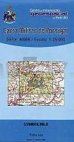
 | 521 - Topographische Landkarte Portugal 1:25.000 Carta Militar de Portugal - Série M888 Instituto Geográfico do Exército (IGeoE) - Portugal |
 | 0233-3 MATANZA DE LOS OTEROS Topographische Landkarte 1:25.000 Spanien (Grundlage MTN25) Instituto Geográfico Nacional - CNIG Spanien - ProjektNord |
 | 782-4 NAVALMEDIO DE MORALES Amtliche topographische Landkarte 1:25.000 Spanien (M.T.N.) 782-4 Mapa Topográfico Nacional de Espana (MTN25) Instituto Geográfico Nacional - CNIG Spanien |
 | 0570-1 ARES DEL MAESTRAT Topographische Landkarte 1:25.000 Spanien (Grundlage MTN25) Instituto Geográfico Nacional - CNIG Spanien - ProjektNord |
 | 540-3 OREA Amtliche topographische Landkarte 1:25.000 Spanien (M.T.N.) 540-3 Mapa Topográfico Nacional de Espana (MTN25) Instituto Geográfico Nacional - CNIG Spanien |
 | 32 IV Topographische Landkarte Portugal 1:50.000 Carta Militar de Portugal Instituto Geográfico do Exército (IGeoE) - Portugal |
 | 567 Pomarao (Mertola) Topographische Landkarte Wanderkarte und Fahrradkarte Portugal 1:25.000 567 Mapa topográfico - Mapa de caminhadas - Portugal 1:25.000 ProjektNord |
 | 0181-2 ESTERRI DÃNEU Topographische Landkarte 1:25.000 Spanien (Grundlage MTN25) Instituto Geográfico Nacional - CNIG Spanien - ProjektNord |
 | 448BIS-449 Vilvestre Amtliche topographische Landkarte 1:50.000 Spanien (M.T.N.) Mapa Topográfico Nacional de Espana (MTN50) Instituto Geográfico Nacional - CNIG Spanien |
 | 64-3 Villabona Amtliche topographische Landkarte 1:25.000 Spanien (M.T.N.) 64-3 Mapa Topográfico Nacional de Espana (MTN25) Instituto Geográfico Nacional - CNIG Spanien |
 | 534-2 FUENTE DEL FRESNO Amtliche topographische Landkarte 1:25.000 Spanien (M.T.N.) 534-2 Mapa Topográfico Nacional de Espana (MTN25) Instituto Geográfico Nacional - CNIG Spanien |
 | 0204-2 MENDAVIA Topographische Landkarte 1:25.000 Spanien (Grundlage MTN25) Instituto Geográfico Nacional - CNIG Spanien - ProjektNord |
 | 0517-2 VALDECONEJOS Topographische Landkarte 1:25.000 Spanien (Grundlage MTN25) Instituto Geográfico Nacional - CNIG Spanien - ProjektNord |
 | 0621-3 BRAMA Topographische Landkarte 1:25.000 Spanien (Grundlage MTN25) Instituto Geográfico Nacional - CNIG Spanien - ProjektNord |
 | 589-4 VILLEL Amtliche topographische Landkarte 1:25.000 Spanien (M.T.N.) 589-4 Mapa Topográfico Nacional de Espana (MTN25) Instituto Geográfico Nacional - CNIG Spanien |
 | 45-4 ABEGONDO Amtliche topographische Landkarte 1:25.000 Spanien (M.T.N.) 45-4 Mapa Topográfico Nacional de Espana (MTN25) Instituto Geográfico Nacional - CNIG Spanien |
 | 0319-3 CASTILRUIZ Topographische Landkarte 1:25.000 Spanien (Grundlage MTN25) Instituto Geográfico Nacional - CNIG Spanien - ProjektNord |
| 3343-NW Topographische Karte 1:10.000 - Landesvermessungsamt Brandenburg |
 | Kirchhundem *** SCHNÃPPCHEN *** Topographische Wanderkarte mit Wanderwegen 1:25.000 - ProjektNord |
 | 0702-4 COVACHA Topographische Landkarte 1:25.000 Spanien (Grundlage MTN25) Instituto Geográfico Nacional - CNIG Spanien - ProjektNord |