| << Portugal: Amtliche topografische Landkarten des Instituto Geográfico do Exército (IGeoE) 1:25.000 (Serie M888) |
||
|
||

Zuletzt angesehene Artikel:
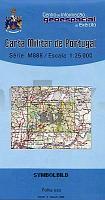
 | 512 - Topographische Landkarte Portugal 1:25.000 Carta Militar de Portugal - Série M888 Instituto Geográfico do Exército (IGeoE) - Portugal |
 | 4252-SO Topographische Karte 1:10.000 - Landesvermessungsamt Brandenburg |
 | 779 Villanueva de la Serena Amtliche topographische Landkarte 1:50.000 Spanien (M.T.N.) 779 Mapa Topográfico Nacional de Espana (MTN50) Instituto Geográfico Nacional - CNIG Spanien |
 | Mulde - Grimma - Colditz (Blatt 05) Topographische Wanderkarte 1:25.000 mit Wanderwegen - ProjektNord |
 | Haut-Pays du Velay à pied 27 promenades & randonnées *** SCHNÃPPCHEN *** - Réf. P436 Topographischer Wanderführer - FFRP (Fédération française de randonnée pédestre) Frankreich |
 | Altmühltal & Fränkisches Seenland Reiseführer Michael-Müller-Verlag - Reiseführer |
| CC 7918 Stuttgart-Süd Bodenübersichtskarte 1:200.000 - Bundesanstalt für Geowissenschaften und Rohstoffe (BGR) |
| CC 6334 Bayreuth Bodenübersichtskarte 1:200.000 - Bundesanstalt für Geowissenschaften und Rohstoffe (BGR) |
 | 468 - Topographische Landkarte Portugal 1:25.000 Carta Militar de Portugal - Série M888 Instituto Geográfico do Exército (IGeoE) - Portugal |
 | 552 Longueira-Almograve (Odemira) Topographische Landkarte Wanderkarte und Fahrradkarte Portugal 1:25.000 552 Mapa topográfico - Mapa de caminhadas - Portugal 1:25.000 ProjektNord |
 | 752 (11-30) Mirandilla Amtliche topographische Landkarte 1:50.000 Spanien (M.T.N.) 752 Mapa Topográfico Nacional de Espana (MTN50) Instituto Geográfico Nacional - CNIG Spanien |
 | 519 Aguaviva Amtliche topographische Landkarte 1:50.000 Spanien (M.T.N.) 519 Mapa Topográfico Nacional de Espana (MTN50) Instituto Geográfico Nacional - CNIG Spanien |
 | 0705 TRUJILLO Topographische Landkarte 1:50.000 Spanien (Grundlage MTN50) Instituto Geográfico Nacional - CNIG Spanien - ProjektNord |
 | 0321-2 TAUSTE Topographische Landkarte 1:25.000 Spanien (Grundlage MTN25) Instituto Geográfico Nacional - CNIG Spanien - ProjektNord |
 | Westerwald - Bad Marienberg - Hachenburg Topographische Wanderkarte Rheinland-Pfalz mit Wanderwegen und Radwegen 1:25.000 - ProjektNord |
 | 505 - Santo Andre Topographische Landkarte Portugal 1:25.000 Carta Militar de Portugal - Série M888 Instituto Geográfico do Exército (IGeoE) - Portugal |
 | 456 - Topographische Landkarte Portugal 1:25.000 Carta Militar de Portugal - Série M888 Instituto Geográfico do Exército (IGeoE) - Portugal |
 | 5903 Neuerburg - Wanderkarte mit Wanderwegen (geplottete Ausgabe) ProjektNord - Grundlage Amtliche topographische Karte Landesamt für Vermessung und Geobasisinformation Rheinland-Pfalz |
 | 774 Ila de Cabrera Amtliche topographische Landkarte 1:50.000 Spanien (M.T.N.) 774 Mapa Topográfico Nacional de Espana (MTN50) Instituto Geográfico Nacional - CNIG Spanien |
 | 0397 ZAMORA SUR Topographische Landkarte 1:50.000 Spanien (Grundlage MTN50) Instituto Geográfico Nacional - CNIG Spanien - ProjektNord |