| << Portugal: Amtliche topografische Landkarten des Instituto Geográfico do Exército (IGeoE) 1:25.000 (Serie M888) |
||
|
||

Zuletzt angesehene Artikel:
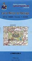
 | 500 - Topographische Landkarte Portugal 1:25.000 Carta Militar de Portugal - Série M888 Instituto Geográfico do Exército (IGeoE) - Portugal |
 | Napasoq - Nuuk - Qeqertarsuatsiaat 1:250.000 Topographische Landkarte (Grüne Serie) Saga Maps Grönland |
 | 5314 (NM 33-12-14) Mistelbach Topographische Wanderkarte 1:50.000 mit Wegmarkierungen - Ãsterreich - Kartographie BEV - ProjektNord |
 | U5143 Jauratustunturi Topographische Karte 1:25.000 EUREF (Peruskartta) Maanmittauslaitos / Lantmäteriverket Finnland - ProjektNord |
 | Florida Bundesstaaten-StraÃenkarte laminiert (Florida - USA) Florida state map laminated |
 | N6122 Värtsilä Topographische Karte 1:25.000 EUREF (Peruskartta) Maanmittauslaitos / Lantmäteriverket Finnland - ProjektNord |
 | Königssteingebirge (Blatt 8) topographische Wanderkarte 1:30.000 (wasserfeste Karte, rum.-engl.) Piatra Craiului Harta turistica / Tourist map Zenith - Rumänien |
 | Wesel Südwest Topographische Wanderkarte Nordrhein-Westfalen mit Wanderwegen und Radwegen 1:25.000 - ProjektNord |
 | Q534 Saunajärvi Topographische Karte 1:50.000 EUREF-FIN (Maastokarttat) Maanmittauslaitos / Lantmäteriverket Finnland - ProjektNord |
 | 702-3 SAN VICENTE DE ALCÃNTARA Amtliche topographische Landkarte 1:25.000 Spanien (M.T.N.) 702-3 Mapa Topográfico Nacional de Espana (MTN25) Instituto Geográfico Nacional - CNIG Spanien |
 | 831-2 ZALAMEA DE LA SERENA Amtliche topographische Landkarte 1:25.000 Spanien (M.T.N.) 831-2 Mapa Topográfico Nacional de Espana (MTN25) Instituto Geográfico Nacional - CNIG Spanien |
 | 44-3 CARBALLO Amtliche topographische Landkarte 1:25.000 Spanien (M.T.N.) 44-3 Mapa Topográfico Nacional de Espana (MTN25) Instituto Geográfico Nacional - CNIG Spanien |
 | 0745-4 CORTES DE PALLÃS Topographische Landkarte 1:25.000 Spanien (Grundlage MTN25) Instituto Geográfico Nacional - CNIG Spanien - ProjektNord |
| 5541 Eibenstock-Aschberg (145) - Geologische Karte 1:25.000 (GK25) Grundlage Vollbornsche Ãquidistantenkarte Sächsisches Landesamt für Umwelt, Landwirtschaft und Geologie |
 | 0072-3 FRIOL Topographische Landkarte 1:25.000 Spanien (Grundlage MTN25) Instituto Geográfico Nacional - CNIG Spanien - ProjektNord |
| 1122 Flensburg Nord - Gestern und Heute - Historische Ãberlagerung 1902-1930 Topographische Landkarte 1:25.000 im Vergleich - Landesvermessungsamt Schleswig-Holstein / ProjektNord |
 | 519-4 BORDÃN Amtliche topographische Landkarte 1:25.000 Spanien (M.T.N.) 519-4 Mapa Topográfico Nacional de Espana (MTN25) Instituto Geográfico Nacional - CNIG Spanien |
 | 0236-3 AMUSCO Topographische Landkarte 1:25.000 Spanien (Grundlage MTN25) Instituto Geográfico Nacional - CNIG Spanien - ProjektNord |
 | 0795-3 ALBAIDA Topographische Landkarte 1:25.000 Spanien (Grundlage MTN25) Instituto Geográfico Nacional - CNIG Spanien - ProjektNord |
 | 0794-3 MOIXENT/MOGENTE Topographische Landkarte 1:25.000 Spanien (Grundlage MTN25) Instituto Geográfico Nacional - CNIG Spanien - ProjektNord |