| << Portugal: Amtliche topografische Landkarten des Instituto Geográfico do Exército (IGeoE) 1:25.000 (Serie M888) |
||
|
||

Zuletzt angesehene Artikel:
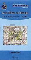
 | 499 Cuba - Topographische Landkarte Portugal 1:25.000 Carta Militar de Portugal - Série M888 Instituto Geográfico do Exército (IGeoE) - Portugal |
 | Naturpark Barnim, Wandlitzer See und Umgebung - Radwander- und Wanderkarte 1:35.000 (Nr. 090) Ausflüge zwischen Oranienburg, Biesenthal, Wandlitz und Bernau. Radwander- und Wanderkarte. 1:35000, Radtourenvorschläge mit Entfernungsangaben. Viele Tipps zu Sehenswürdigkeiten. GPS-fähig. Mit QR-Code Dr. Barthel Verlag |
 | Forest of Bowland Fahrrad- und Wanderkarte 1:55.000/1:25.000 Area of Outstanding Natural Beauty (AONB) - Superwalker - HARVEY MAPS Forest of Bowland cycling & walking map for walkers, cyclists and horseriders - Area of Outstanding Natural Beauty (AONB) - Superwalker - double-sided, waterproof |
 | 886-4 VILLANUEVA DEL ARZOBISPO Amtliche topographische Landkarte 1:25.000 Spanien (M.T.N.) 886-4 Mapa Topográfico Nacional de Espana (MTN25) Instituto Geográfico Nacional - CNIG Spanien |
 | 138 (22-08) Nanclares de la Oca / Langraiz Oka Amtliche topographische Landkarte 1:50.000 Spanien (M.T.N.) 138 Mapa Topográfico Nacional de Espana (MTN50) Instituto Geográfico Nacional - CNIG Spanien |
 | 289-1 BENABARRE Amtliche topographische Landkarte 1:25.000 Spanien (M.T.N.) 289-1 Mapa Topográfico Nacional de Espana (MTN25) Instituto Geográfico Nacional - CNIG Spanien |
 | 753-3 Conquista del Guadiana Amtliche topographische Landkarte 1:25.000 Spanien (M.T.N.) 753-3 Mapa Topográfico Nacional de Espana (MTN25) Instituto Geográfico Nacional - CNIG Spanien |
 | 215 (34-10) La Seu d´Urgell Amtliche topographische Landkarte 1:50.000 Spanien (M.T.N.) 215 Mapa Topográfico Nacional de Espana (MTN50) Instituto Geográfico Nacional - CNIG Spanien |
 | 629-4 STA.MARIA DE BENQUERENCIA Amtliche topographische Landkarte 1:25.000 Spanien (M.T.N.) 629-4 Mapa Topográfico Nacional de Espana (MTN25) Instituto Geográfico Nacional - CNIG Spanien |
 | 243-1 EL VILLAR DE ARNEDO Amtliche topographische Landkarte 1:25.000 Spanien (M.T.N.) 243-1 Mapa Topográfico Nacional de Espana (MTN25) Instituto Geográfico Nacional - CNIG Spanien |
 | Oberes Saaletal, Bleilochtalsperre und Umgebung - Radwander- und Wanderkarte 1:35.000 (Nr. 126) Ausflüge in der Region Thüringer Meer zwischen Ziegenrück, Schleiz, Burgk und Saalburg-Ebersdorf. Radwander- und Wanderkarte, Radtourenvorschläge mit Entfernungsangaben. Viele Tipps zu Sehenswürdigkeiten. GPS-fähig. 1:35000 Dr. Barthel Verlag |
 | 442 - Barreiro Topographische Landkarte Portugal 1:25.000 Carta Militar de Portugal - Série M888 Instituto Geográfico do Exército (IGeoE) - Portugal |
 | 284 Ejea de los Caballeros Amtliche topographische Landkarte 1:50.000 Spanien (M.T.N.) 284 Mapa Topográfico Nacional de Espana (MTN50) Instituto Geográfico Nacional - CNIG Spanien |
 | 351-4 SIERRA DE TORANZO Amtliche topographische Landkarte 1:25.000 Spanien (M.T.N.) 351-4 Mapa Topográfico Nacional de Espana (MTN25) Instituto Geográfico Nacional - CNIG Spanien |
 | 354-IV (54-28) Utebo Amtliche topographische Landkarte 1:25.000 Spanien (M.T.N.) 354-IV Mapa Topográfico Nacional de Espana (MTN25) Instituto Geográfico Nacional - CNIG Spanien |
 | 445 (33-17) La Selva del Camp Amtliche topographische Landkarte 1:50.000 Spanien (M.T.N.) 445 Mapa Topográfico Nacional de Espana (MTN50) Instituto Geográfico Nacional - CNIG Spanien |
 | 900 La Cardenchosa Amtliche topographische Landkarte 1:50.000 Spanien (M.T.N.) 900 Mapa Topográfico Nacional de Espana (MTN50) Instituto Geográfico Nacional - CNIG Spanien |
 | 753 (13-30) Miajadas Amtliche topographische Landkarte 1:50.000 Spanien (M.T.N.) 753 Mapa Topográfico Nacional de Espana (MTN50) Instituto Geográfico Nacional - CNIG Spanien |
 | Volcan Cantalien à pied + VTT - Auvergne Wanderführer - Mountainbikeführer (französisch) Volcan Cantalien à pied + VTT - Auvergne - Balades à pied Chamina - Frankreich |
 | Leipzig und Umgebung 1:75.000 (Blatt SAX01) Grimma, Halle/Saale, Merseburg, Naumburg, WeiÃenfels, Wurzen - bikeline-Radkarte 1:75.000 Deutschland Esterbauer |