| << Portugal: Amtliche topografische Landkarten des Instituto Geográfico do Exército (IGeoE) 1:25.000 (Serie M888) |
||
|
||

Zuletzt angesehene Artikel:
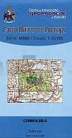
 | 456 - Topographische Landkarte Portugal 1:25.000 Carta Militar de Portugal - Série M888 Instituto Geográfico do Exército (IGeoE) - Portugal |
 | 5903 Neuerburg - Wanderkarte mit Wanderwegen (geplottete Ausgabe) ProjektNord - Grundlage Amtliche topographische Karte Landesamt für Vermessung und Geobasisinformation Rheinland-Pfalz |
 | 774 Ila de Cabrera Amtliche topographische Landkarte 1:50.000 Spanien (M.T.N.) 774 Mapa Topográfico Nacional de Espana (MTN50) Instituto Geográfico Nacional - CNIG Spanien |
 | 0397 ZAMORA SUR Topographische Landkarte 1:50.000 Spanien (Grundlage MTN50) Instituto Geográfico Nacional - CNIG Spanien - ProjektNord |
 | 201 Parco Nazionale Arcipelago Toscano 1:25.000/1:15.000(extra wasser- und reiÃfest) *** SCHNÃPPCHEN *** Wander-und Mountainbikekartenset - 4land |
 | 865 Siles Amtliche topographische Landkarte 1:50.000 Spanien (M.T.N.) 865 Mapa Topográfico Nacional de Espana (MTN50) Instituto Geográfico Nacional - CNIG Spanien |
 | C8722 Lindau im Bodensee Topographische Karte 1:100.000 - ProjektNord - Kartographie Bayrisches Landesvermessungsamt |
 | 887 Orcera Amtliche topographische Landkarte 1:50.000 Spanien (M.T.N.) 887 Mapa Topográfico Nacional de Espana (MTN50) Instituto Geográfico Nacional - CNIG Spanien |
 | Da Santa Margherita a Calasetta (italienisch/englisch) Wanderkarte Sardinien 1:60.000 Carta turistica della Sardegna (2) Edizioni Abies |
 | Jersey & Guernsey 1:18.000 StraÃenkarte ITMB International Travel Maps |
 | 465 Daroca Amtliche topographische Landkarte 1:50.000 Spanien (M.T.N.) 465 Mapa Topográfico Nacional de Espana (MTN50) Instituto Geográfico Nacional - CNIG Spanien |
 | RegionenKarte Rheinland-Pfalz/Saarland 1:200.000. Blatt Süd *** SCHNÃPPCHEN *** - Landesvermessungsamt Rheinland-Pfalz |
 | 14 Heidiland - Sarganerland Wanderkarte Schweiz 1:50.000 Hallwag |
 | 780 Puebla de Alcocer (14-31) Amtliche topographische Landkarte 1:50.000 Spanien (M.T.N.) 780 Mapa Topográfico Nacional de Espana (MTN50) Instituto Geográfico Nacional - CNIG Spanien |
 | 5706 Hillesheim - Wanderkarte mit Wanderwegen (geplottete Ausgabe) ProjektNord - Grundlage Amtliche topographische Karte Landesamt für Vermessung und Geobasisinformation Rheinland-Pfalz |
 | 3041-SO Topographische Karte 1:10.000 - Landesvermessungsamt Brandenburg |
 | 445 (33-17) La Selva del Camp Amtliche topographische Landkarte 1:50.000 Spanien (M.T.N.) 445 Mapa Topográfico Nacional de Espana (MTN50) Instituto Geográfico Nacional - CNIG Spanien |
| NJ 38-10 Hakkari Amtliche Topographische Karte der Türkei 1:250.000 NJ 38-10 Hakkari - Müşterek Harekat Haritası HGK |
 | 513 - Topographische Landkarte Portugal 1:25.000 Carta Militar de Portugal - Série M888 Instituto Geográfico do Exército (IGeoE) - Portugal |
 | Ionisches Meer - Hafenführer (Band 4) *** SCHNÃPPCHEN *** Griechenland: Korfu bis Korinth und Kythira - von Axel Kramer - See-Verlag |