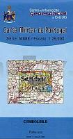
| << Portugal: Amtliche topografische Landkarten des Instituto Geográfico do Exército (IGeoE) 1:25.000 (Serie M888) |
||
|
||

Zuletzt angesehene Artikel:
 | 454 Setúbal Topographische Landkarte Portugal 1:25.000 Carta Militar de Portugal - Série M888 Instituto Geográfico do Exército (IGeoE) - Portugal |
 | 0701 VALENCIA DE ALCÃNTARA Topographische Landkarte 1:50.000 Spanien (Grundlage MTN50) Instituto Geográfico Nacional - CNIG Spanien - ProjektNord |
 | 476 Topographische Landkarte Wanderkarte und Fahrradkarte Portugal 1:25.000 476 Mapa topográfico - Mapa de caminhadas - Portugal 1:25.000 ProjektNord |
 | 570 Amtliche topographische Landkarte 1:50.000 Spanien (M.T.N.) 570 Mapa Topográfico Nacional de Espana (MTN50) Instituto Geográfico Nacional - CNIG Spanien |
 | 12 Ilhas Desertas (Madeira) - Topografische Karte Portugal 1:25.000 Carta Militar de Portugal - Série P821 - 1/25 000 (Madeira) - Instituto Geográfico do Exército (IGeoE) - Portugal |
 | 484-4 LA CABRERA Amtliche topographische Landkarte 1:25.000 Spanien (M.T.N.) 484-4 Mapa Topográfico Nacional de Espana (MTN25) Instituto Geográfico Nacional - CNIG Spanien |
 | 0477-1 SANDO Topographische Landkarte 1:25.000 Spanien (Grundlage MTN25) Instituto Geográfico Nacional - CNIG Spanien - ProjektNord |
 | 490 Odón Amtliche topographische Landkarte 1:50.000 Spanien (M.T.N.) 490 Mapa Topográfico Nacional de Espana (MTN50) Instituto Geográfico Nacional - CNIG Spanien |
 | 0465-1 DAROCA Topographische Landkarte 1:25.000 Spanien (Grundlage MTN25) Instituto Geográfico Nacional - CNIG Spanien - ProjektNord |
 | 0348-1 SAN LEONARDO DE YAGÃE Topographische Landkarte 1:25.000 Spanien (Grundlage MTN25) Instituto Geográfico Nacional - CNIG Spanien - ProjektNord |
 | 5312 Hachenburg - Wanderkarte mit Wanderwegen (geplottete Ausgabe) ProjektNord - Grundlage Amtliche topographische Karte Landesamt für Vermessung und Geobasisinformation Rheinland-Pfalz |
 | 412 Topographische Landkarte Wanderkarte und Fahrradkarte Portugal 1:25.000 412 Mapa topográfico - Mapa de caminhadas - Portugal 1:25.000 ProjektNord |
| L38-4-A Oktjabrskij 1:50.000 - Amtliche Topographische Karte der Russischen Föderation |
 | 490 Topographische Landkarte Wanderkarte und Fahrradkarte Portugal 1:25.000 490 Mapa topográfico - Mapa de caminhadas - Portugal 1:25.000 ProjektNord |
 | 0655-2 SAN MARTÃN DE PUSA Topographische Landkarte 1:25.000 Spanien (Grundlage MTN25) Instituto Geográfico Nacional - CNIG Spanien - ProjektNord |
 | 720 Requena Amtliche topographische Landkarte 1:50.000 Spanien (M.T.N.) 720 Mapa Topográfico Nacional de Espana (MTN50) Instituto Geográfico Nacional - CNIG Spanien |
 | 0465-2 ROMANOS Topographische Landkarte 1:25.000 Spanien (Grundlage MTN25) Instituto Geográfico Nacional - CNIG Spanien - ProjektNord |
 | 486-2 JADRAQUE Amtliche topographische Landkarte 1:25.000 Spanien (M.T.N.) 486-2 Mapa Topográfico Nacional de Espana (MTN25) Instituto Geográfico Nacional - CNIG Spanien |
 | 0764-3 MUNERA Topographische Landkarte 1:25.000 Spanien (Grundlage MTN25) Instituto Geográfico Nacional - CNIG Spanien - ProjektNord |
 | 6714 Edenkoben - Wanderkarte mit Wanderwegen (geplottete Ausgabe) ProjektNord - Grundlage Amtliche topographische Karte Landesamt für Vermessung und Geobasisinformation Rheinland-Pfalz |