| << Portugal: Amtliche topografische Landkarten des Instituto Geográfico do Exército (IGeoE) 1:25.000 (Serie M888) |
||
|
||

Zuletzt angesehene Artikel:
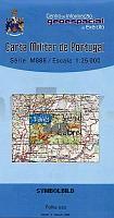
 | 445 - Topographische Landkarte Portugal 1:25.000 Carta Militar de Portugal - Série M888 Instituto Geográfico do Exército (IGeoE) - Portugal |
 | Karadsch - Touristischer Stadtplan-Atlas Zentrum und Gemeinde (Nr. 392) StraÃenatlas Englisch und Persisch اطلس گردشگري شهر و شهرستان كرج - Tourist Atlas of Karaj City & Township Gitashenasi - Iran |
 | 55O HULST (Oost) Topographische Karte der Niederlande 1:50.000 Topografische Dienst (Plotausgabe) |
 | 115I - Carmacks Topographische Landkarte 1:250.000 - Canada - Yukon |
 | Lorestan - Touristische Landkarte - Provinz-StraÃenkarte 1:300.000 (Blatt 191) Landkarte / StraÃenkarte (englisch) The Tourism Map of Lorestan - لرستان Iranshenasi - Iran |
 | Geographischer Atlas der Ukraine Kompleksnyj Atlas Ukaini Kartografija - ukrmap Ukraine |
 | Ferienregion Oberhof - Thüringer Wald Winterkarte 1:35.000 - grünes herz |
 | 7543 Pfarrkirchen Topographische Landkarte Bayern 1:25.000 - Normalausgabe - ProjektNord (geplottete Ausgabe) - Grundlage amtliche Topographische Karte Bayern DTK25 |
 | Q3313 Stubben Topographische Karte 1:25.000 EUREF (Peruskartta) Maanmittauslaitos / Lantmäteriverket Finnland - ProjektNord |
 | 7029 Oettingen Bayern Topographische Landkarte Bayern 1:25.000 - Normalausgabe - ProjektNord (geplottete Ausgabe) - Grundlage amtliche Topographische Karte Bayern DTK25 |
 | La Serrella Wanderkarte 1:20.000 El Tossal Cartographies - Valencia - Spanien La Vall de Seta - la Vall de Guadalest |
 | 6022 Rothenbuch Topographische Landkarte Bayern 1:25.000 - Normalausgabe - ProjektNord (geplottete Ausgabe) - Grundlage amtliche Topographische Karte Bayern DTK25 |
| 3670 Nekla Topographische Karte 1:25.000 Messtischblatt des Deutschen Reiches - PreuÃische Landesaufnahme / Reichsamt für Landesaufnahme - Faksimile ProjektNord |
 | 1115 IV Sotra Amtliche Topographische Karte Norwegen 1:50.000 - Statens Kartverk - Norwegen |
 | 5635 Nordhalben Topographische Landkarte Bayern 1:25.000 - Normalausgabe - ProjektNord (geplottete Ausgabe) - Grundlage amtliche Topographische Karte Bayern DTK25 |
 | L3414 Vahto Topographische Karte 1:25.000 EUREF (Peruskartta) Maanmittauslaitos / Lantmäteriverket Finnland - ProjektNord |
 | Frankreich 1:1.6 Mio. Mini Pocket map country - comfort!map wasserfest - laminiert - France ExpressMap |
 | L4123 Vihti Topographische Karte 1:25.000 EUREF (Peruskartta) Maanmittauslaitos / Lantmäteriverket Finnland - ProjektNord |
 | 3655 Reppen Topographische Karte 1:25.000 Messtischblatt des Deutschen Reiches - PreuÃische Landesaufnahme / Reichsamt für Landesaufnahme - Faksimile ProjektNord |
 | 7743 Marktl Topographische Landkarte Bayern 1:25.000 - Normalausgabe - ProjektNord (geplottete Ausgabe) - Grundlage amtliche Topographische Karte Bayern DTK25 |