| << Portugal: Amtliche topografische Landkarten des Instituto Geográfico do Exército (IGeoE) 1:25.000 (Serie M888) |
||
|
||

Zuletzt angesehene Artikel:
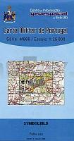
 | 425 - Topographische Landkarte Portugal 1:25.000 Carta Militar de Portugal - Série M888 Instituto Geográfico do Exército (IGeoE) - Portugal |
 | Frankfurt am Main 1920 Historischer Stadtplan 1:10.500 Nachdruck - Pharus-Plan |
 | Münster - Osnabrück (Nr. 863) *** SCHNÃPPCHEN *** Wanderkarten-Set mit Radrouten. GPS-genau. 1:35000 - von KOMPASS-Karten GmbH |
 | V5113 Topographische Karte 1:25.000 EUREF (Peruskartta) Maanmittauslaitos / Lantmäteriverket Finnland - ProjektNord |
 | 2773 Wtelno Topographische Karte 1:25.000 Messtischblatt des Deutschen Reiches - PreuÃische Landesaufnahme / Reichsamt für Landesaufnahme - Faksimile ProjektNord |
 | 6642 Waldmünchen Topographische Landkarte Bayern 1:25.000 - Normalausgabe - ProjektNord (geplottete Ausgabe) - Grundlage amtliche Topographische Karte Bayern DTK25 |
 | N4142 Haapamäki Topographische Karte 1:25.000 EUREF (Peruskartta) Maanmittauslaitos / Lantmäteriverket Finnland - ProjektNord |
 | 105O12 Fango Lake - Yukon Territory Topographische Landkarte 1:50.000 - Canada - Yukon |
 | 474 (4106) Slowakisches Paradies (Zoom) Wanderkarte Slowakei 1:40.000 - SHOCart Slovenský Raj - SHOCart |
 | Vaux-sur-Sûre NGI 1:25.000 Touristische Landkarte und Wanderkarte Belgien |
 | 6032 ScheÃlitz Topographische Landkarte Bayern 1:25.000 - Normalausgabe - ProjektNord (geplottete Ausgabe) - Grundlage amtliche Topographische Karte Bayern DTK25 |
 | Dänemark 1:500.000 - POSTER ca. 66 x 75 cm Danmark ProjektNord |
 | 6531 Fürth Topographische Landkarte Bayern 1:25.000 - Normalausgabe - ProjektNord (geplottete Ausgabe) - Grundlage amtliche Topographische Karte Bayern DTK25 |
| 2573 Klonowo Topographische Karte 1:25.000 Messtischblatt des Deutschen Reiches - PreuÃische Landesaufnahme / Reichsamt für Landesaufnahme - Faksimile ProjektNord |
 | N5433 Saario Topographische Karte 1:25.000 EUREF (Peruskartta) Maanmittauslaitos / Lantmäteriverket Finnland - ProjektNord |
 | 6837 Kallmünz Topographische Landkarte Bayern 1:25.000 - Normalausgabe - ProjektNord (geplottete Ausgabe) - Grundlage amtliche Topographische Karte Bayern DTK25 |
 | 6327 Markt Einersheim Topographische Landkarte Bayern 1:25.000 - Normalausgabe - ProjektNord (geplottete Ausgabe) - Grundlage amtliche Topographische Karte Bayern DTK25 |
 | Saint-Léger en Gaume 1:25.000 Touristische Landkarte und Wanderkarte / Radwanderkarte Belgien NGI Belgien |
 | CC 3934 Magdeburg Topographische Ãbersichtskarte 1:200.000 - Bundesamt für Kartografie und Geodäsie und Landesvermessungsämter - ProjektNord |
| Giant Forest 1:35.000 (Blatt 320) California Landkarte wasserfest - Trails Illustrated Map - National Geographic - USA National Geographic |