| << Portugal: Amtliche topografische Landkarten des Instituto Geográfico do Exército (IGeoE) 1:25.000 (Serie M888) |
||
|
||

Zuletzt angesehene Artikel:
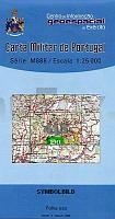
 | 413 - Topographische Landkarte Portugal 1:25.000 Carta Militar de Portugal - Série M888 Instituto Geográfico do Exército (IGeoE) - Portugal |
 | 51 Hana - Prostejov, Konick und Litovel Wanderkarte Tschechien 1:50.000 - KCT - Papierausgabe 51 Haná Prostějovsko, Konicko a Litovelsko |
 | Tiroler Zugspitz Arena XL (Blatt 412) 1:25.000 - Ehrwald, Lermoos, Biberwier, Lähn/Wengle, Bichlbach, Berwang, Heiterwang, Plansee, Namlos - Wander-, Rad- und MTB-Karte - Walter Mayr - KOMPASS |
 | 16 Limburg 1:50.000 - De sterkste fietskart van de Regio Fahrradkarte Niederlande Buijten & Schipperheijn |
 | Q5443 Mahakas Topographische Karte 1:25.000 EUREF (Peruskartta) Maanmittauslaitos / Lantmäteriverket Finnland - ProjektNord |
 | Cache La Pouder - Big Thompson - Colorado (Blatt: 101) Landkarte Trails Illustrated Map National Geographic - USA |
 | J13 Regensburg-Süd - Kelheim - Bad Abbach - Nittendorf - Schierling - Saal a.d.Donau - Sinzing *** SCHNÃPPCHEN *** ATK25 Topographische Karte 1:25.000 (Atkis) Bayern Landesvermessungsamt Bayern - Wanderkarte |
 | 404 - Topographische Landkarte Portugal 1:25.000 Carta Militar de Portugal - Série M888 Instituto Geográfico do Exército (IGeoE) - Portugal |
 | 0340-1 MANGANESES DE LA LAMPREANA Topographische Landkarte 1:25.000 Spanien (Grundlage MTN25) Instituto Geográfico Nacional - CNIG Spanien - ProjektNord |
 | Hildburghausen, Römhild und Umgebung - Radwander- und Wanderkarte 1:35.000 (Nr. 169) Ausflüge zwischen Themar, Schleusingen, Straufhain, Bad Rodach und dem Schloss Irmelshausen. Radwander- und Wanderkarte, Radtourenvorschläge mit Entfernungsangaben. Viele Tipps zu Sehenswürdigkeiten. GPS-fähig Dr. Barthel Verlag |
 | 5215 (NL 33-03-15) Sankt Nikolaus Topographische Wanderkarte 1:50.000 mit Wegmarkierungen - Ãsterreich - Kartographie BEV - ProjektNord |
 | U5212 Topographische Karte 1:25.000 EUREF (Peruskartta) Maanmittauslaitos / Lantmäteriverket Finnland - ProjektNord |
 | Provinz Fujian (China) Ãbersichtskarte 1:600.000 Vermessungsamt der Provinz Fujian - Landesamt für Vermessung und Geobasisinformation Rheinland-Pfalz |
 | Everglades National Park 1:100.000 (Blatt 243) GPS / Florida Landkarte Trails Illustrated Map wasserfest National Geographic - USA |
 | Radwander- und Wanderkarte Flusslandschaft Burg - Jerichow - Tangermünde und Umgebung Ausflüge zwischen der Altmark, Wolmirstedt, Genthin, Schönhausen und Colbitz-Letzlinger Heide - von Verlag Dr. Barthel - Barthel, A |
 | 447 - Topographische Landkarte Portugal 1:25.000 Carta Militar de Portugal - Série M888 Instituto Geográfico do Exército (IGeoE) - Portugal |
 | Foggia Provinzialautokarte - StraÃenkarte 1:150.000 - Italien Foggia - Carta stradale della Provincia - Italia L.A.C. GlobalMap Italien |
 | Frankreich Nord 1:1 Mio. StraÃenkarte (Blatt 724) France Nord Michelin |
 | Mit dem Wohnmobil in die Französischen Alpen (Band 91) - von Heiner Newe, Heiderose Thomsen-Newe - Womo |
 | G2 Foynøya Spitzbergen / Svalbard / Spitsbergen - Topographische Karte 1:100.000 Norsk Polarinstitutt |