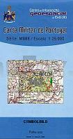
| << Portugal: Amtliche topografische Landkarten des Instituto Geográfico do Exército (IGeoE) 1:25.000 (Serie M888) |
||
|
||

Zuletzt angesehene Artikel:
 | 363 Aveiras de Cima (Azambuja) Topographische Landkarte Portugal 1:25.000 Carta Militar de Portugal - Série M888 Instituto Geográfico do Exército (IGeoE) - Portugal |
 | 1003 UTRERA Topographische Landkarte 1:50.000 Spanien (Grundlage MTN50) Instituto Geográfico Nacional - CNIG Spanien - ProjektNord |
 | 182 (34-09) Ribera de Cardós Amtliche topographische Landkarte 1:50.000 Spanien (M.T.N.) 182 182 Ribera de Cardós - Mapa Topográfico Nacional de Espana (MTN50) Instituto Geográfico Nacional - CNIG Spanien |
 | 198 - Topographische Landkarte Portugal 1:25.000 Carta Militar de Portugal - Série M888 Instituto Geográfico do Exército (IGeoE) - Portugal |
 | 6711 Pirmasens Nord - Wanderkarte mit Wanderwegen (geplottete Ausgabe) ProjektNord - Grundlage Amtliche topographische Karte Landesamt für Vermessung und Geobasisinformation Rheinland-Pfalz |
 | 195 - Topographische Landkarte Portugal 1:25.000 Carta Militar de Portugal - Série M888 Instituto Geográfico do Exército (IGeoE) - Portugal |
 | 137 Miranda de ebro Amtliche topographische Landkarte 1:50.000 Spanien (M.T.N.) 137 Mapa Topográfico Nacional de Espana (MTN50) Instituto Geográfico Nacional - CNIG Spanien |
 | 17 Lindoso (Pnte da Barca) Topographische Landkarte Wanderkarte und Fahrradkarte Portugal 1:25.000 017 Mapa topográfico - Mapa de caminhadas - Portugal 1:25.000 ProjektNord |
 | 920 (13-37) Costantina Amtliche topographische Landkarte 1:50.000 Spanien (M.T.N.) 920 Mapa Topográfico Nacional de Espana (MTN50) Instituto Geográfico Nacional - CNIG Spanien |
 | 134 Polientes Amtliche topographische Landkarte 1:50.000 Spanien (M.T.N.) 134 Mapa Topográfico Nacional de Espana (MTN50) Instituto Geográfico Nacional - CNIG Spanien |
 | C1118 Süderlügum Topographische Landkarte 1:100.000 Landesvermessungsamt Schleswig-Holstein |
 | C6326 Kitzingen Topographische Karte 1:100.000 - ProjektNord - Kartographie Bayrisches Landesvermessungsamt |
 | 660 Corral de Almaguer Amtliche topographische Landkarte 1:50.000 Spanien (M.T.N.) 660 Mapa Topográfico Nacional de Espana (MTN50) Instituto Geográfico Nacional - CNIG Spanien |
 | 1004 Marchena Amtliche topographische Landkarte 1:50.000 Spanien (M.T.N.) 1004 Mapa Topográfico Nacional de Espana (MTN50) Instituto Geográfico Nacional - CNIG Spanien |
 | 890 Calasparra Amtliche topographische Landkarte 1:50.000 Spanien (M.T.N.) 890 Mapa Topográfico Nacional de Espana (MTN50) Instituto Geográfico Nacional - CNIG Spanien |
 | 120 - Topographische Landkarte Portugal 1:25.000 Carta Militar de Portugal - Série M888 Instituto Geográfico do Exército (IGeoE) - Portugal |
 | 602 Navamorcuende Amtliche topographische Landkarte 1:50.000 Spanien (M.T.N.) 602 Mapa Topográfico Nacional de Espana (MTN50) Instituto Geográfico Nacional - CNIG Spanien |
 | 198 Osorno Amtliche topographische Landkarte 1:50.000 Spanien (M.T.N.) 198 Mapa Topográfico Nacional de Espana (MTN50) Instituto Geográfico Nacional - CNIG Spanien |
 | 3648 Wernsdorf Sonderausgabe mit Wanderwegen - Topographische Wanderkarte Brandenburg 1:25.000 ProjektNord |
 | 105K01 - Tenas Creek Topographische Landkarte 1:50.000 - Canada - Yukon |