Willkommen bei MapFox
+++ Buchhändleranfragen willkommen! Tel. 0431-666 75 99 +++
Warenkorb
Artikel: 0 - € 0.00
Zur Kasse
Impressum Kontakt Versandkosten AGB
362 Ramalhal (Torres Vedras) Topographische Landkarte Portugal 1:25.000 Carta Militar de Portugal - Série M889 Instituto Geográfico do Exército (IGeoE) - Portugal
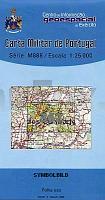
<< Portugal: Amtliche topografische Landkarten des Instituto Geográfico do Exército (IGeoE) 1:25.000
 

Gesamtliste mit Blattübersicht

Kartenbeispiel aus der Serie

Kartenausschnitt

362 Ramalhal (Torres Vedras) Topographische Landkarte Portugal 1:25.000 Carta Militar de Portugal - Série M889 Instituto Geográfico do Exército (IGeoE) - Portugal
EAN / ISBN: 9789727903603
Preis: EUR 17.90

Bestellartikel: versandfertig in ca. 2 Wochen oder länger. Dieser Artikel wird speziell für Sie bestellt. Keine Rücknahme!
Produkt EUR Anzahl Bestellen
362 Ramalhal (Torres Vedras) Topographische Landkarte Portugal 1:25.000 Carta Militar de Portugal - Série M889 Instituto Geográfico do Exército (IGeoE) - Portugal 17.90
Versandkostenfrei in Deutschland ab 20,- Bestellwert

incl. MwSt.

Stichworte, die bei der Suche nützlich sein könnten:
Ramalhal (Torres Vedras) - Vila Nova - Vilar - Maxial - Ermegeira - Campelos - Portugal - topografische Wanderkarten - Serie M888 - Série M888 - M888

Zuletzt angesehene Artikel:

Noch kein Cover vorhanden362 Ramalhal (Torres Vedras) Topographische Landkarte Portugal 1:25.000 Carta Militar de Portugal - Série M889 Instituto Geográfico do Exército (IGeoE) - Portugal

CoverCC 7110 Mannheim Geologische Übersichtskarte 1:200.000 - Bundesanstalt für Geowissenschaften und Rohstoffe (BGR)

Cover63-I (45-09) Ondarroa Amtliche topographische Landkarte 1:25.000 Spanien (M.T.N.)
63-I Mapa Topográfico Nacional de Espana (MTN25) Instituto Geográfico Nacional - CNIG Spanien

Cover695-3 COLONIA DEL ROMERAL Amtliche topographische Landkarte 1:25.000 Spanien (M.T.N.)
695-3 Mapa Topográfico Nacional de Espana (MTN25) Instituto Geográfico Nacional - CNIG Spanien

Cover654 El Puente del Arzobispo Amtliche topographische Landkarte 1:50.000 Spanien (M.T.N.)
654 Mapa Topográfico Nacional de Espana (MTN50) Instituto Geográfico Nacional - CNIG Spanien

Cover358-1 BINACED Amtliche topographische Landkarte 1:25.000 Spanien (M.T.N.)
358-1 Mapa Topográfico Nacional de Espana (MTN25) Instituto Geográfico Nacional - CNIG Spanien

CoverVibo Valentia Provinzialautokarte - Straßenkarte 1:100.000 - Italien
Vibo Valentia - Carta stradale della Provincia L.A.C. GlobalMap Italien

Noch kein Cover vorhanden3042-NO Topographische Karte 1:10.000 - Landesvermessungsamt Brandenburg

CoverVenedig Stadtplan 1:7.500
Venezia - Pianta della Citta L.A.C. GlobalMap Italien

Cover681-1 CASTAÑAR DE IBOR Amtliche topographische Landkarte 1:25.000 Spanien (M.T.N.)
681-1 Mapa Topográfico Nacional de Espana (MTN25) Instituto Geográfico Nacional - CNIG Spanien

Cover6519 Eberbach Topographische Landkarte 1:25.000 - Landesvermessungsamt Baden-Württemberg

CoverLandgüter in Estland 1:425.000 Touristische Landkarte
Eesti Mõisat / Estonian manors REGIO Estland

Cover3734 08+4712 05 Vaklivaara Topographische Karte 1:20.000 (Maastokartta / Peruskartta / Grundkarta) Maanmittauslaitos / Lantmäteriverket Finnland - ProjektNord

Cover3814 09 Isonpaanteenvaa Topographische Karte 1:20.000 (Maastokartta / Peruskartta / Grundkarta) Maanmittauslaitos / Lantmäteriverket Finnland - ProjektNord

Cover32W AMERSFOORT (West) Topographische Karte der Niederlande 1:50.000 Topografische Dienst (Plotausgabe)

CoverEuropäische Union 1:6 Mio. (franz.) Straßenkarte
Union européenne IGN

Cover3931 11 Iijärvi Topographische Karte 1:20.000 (Maastokartta / Peruskartta / Grundkarta) Maanmittauslaitos / Lantmäteriverket Finnland - ProjektNord

CoverReiseführer Ostholstein Mit Lübecker Bucht, Fehmarn und Lauenburg - von Tanja Schridde - TRESCHER

Noch kein Cover vorhanden36 I Topographische Landkarte Portugal 1:50.000 Carta Militar de Portugal Instituto Geográfico do Exército (IGeoE) - Portugal

Noch kein Cover vorhandenErläuterungen zur Geologischen Karte 4444 Torgau-Ost - Ausgabe 1930 Sächsisches Landesamt für Umwelt, Landwirtschaft und Geologie