| << Portugal: Amtliche topografische Landkarten des Instituto Geográfico do Exército (IGeoE) 1:25.000 (Serie M888) |
||
|
||

Zuletzt angesehene Artikel:
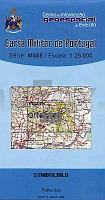
 | 359 - Topographische Landkarte Portugal 1:25.000 Carta Militar de Portugal - Série M888 Instituto Geográfico do Exército (IGeoE) - Portugal |
 | L16 Reisbach mit Arnstorf - Eichendorf Landau a. d. Isar - Malgersdorf - Mamming - Simbach *** SCHNÃPPCHEN *** ATK25 Topographische Karte 1:25.000 (Atkis) Bayern Landesvermessungsamt Bayern - Wanderkarte |
 | 6713 Annweiler am Trifels - Wanderkarte mit Wanderwegen (geplottete Ausgabe) ProjektNord - Grundlage Amtliche topographische Karte Landesamt für Vermessung und Geobasisinformation Rheinland-Pfalz |
 | Cykelkartan Blad 21 Vättern runt, norra delen (wasserfest) *** SCHNÃPPCHEN *** Fahrradkarte Schweden 1:90.000 - Norstedts |
 | 3146 Liebenwalde Sonderausgabe mit Wanderwegen - Topographische Wanderkarte Brandenburg 1:25.000 ProjektNord |
 | L-34-3 Vac Amtliche Topographische Karte Ungarn 1:100.000 |
| 6 II c - Topographische Landkarte Portugal 1:50.000 Carta Militar de Portugal Instituto Geográfico do Exército (IGeoE) - Portugal |
 | Lyck Kreiskarte des Deutschen Reiches 1:100.000 (KDR 100 KK) - Faksimile Reichsamt für Landesaufnahme |
 | 2948 Friedrichswalde Sonderausgabe mit Wanderwegen - Topographische Wanderkarte Brandenburg 1:25.000 ProjektNord |
| 4352-SO Topographische Karte 1:10.000 - Landesvermessungsamt Brandenburg |
 | Q5134 Valtimo Topographische Karte 1:25.000 EUREF (Peruskartta) Maanmittauslaitos / Lantmäteriverket Finnland - ProjektNord |
 | 3946 Baruth/Mark - Paplitz Sonderausgabe mit Wanderwegen - Topographische Wanderkarte Brandenburg 1:25.000 ProjektNord |
 | 356 - Topographische Landkarte Portugal 1:25.000 Carta Militar de Portugal - Série M888 Instituto Geográfico do Exército (IGeoE) - Portugal |
| Nansen Land (Blatt 8) 1:500.000 Ultima Thule Serie (Gelbe Serie) Topographische Landkarte Saga Maps Grönland |
 | 0348-4 MURIEL DE LA FUENTE Topographische Landkarte 1:25.000 Spanien (Grundlage MTN25) Instituto Geográfico Nacional - CNIG Spanien - ProjektNord |
 | Budapest - Mad`arsko - Ungarn Stadtplan 1:20.000 / Landkarte 1:500.000 SHOCart |
 | N10 Fürstenfeldbruck - Olching, Schwabhausen, Puchheim, Mammendorf, Maisach, Odelzhausen ATK25 Topographische Karte 1:25.000 (Atkis) Bayern Landesvermessungsamt Bayern - Wanderkarte |
| Frederick E. Hyde Fjord (Blatt 9) 1:500.000 Ultima Thule Serie (Gelbe Serie) Topographische Landkarte Saga Maps Grönland |
 | Nord Dakota / Süd Dakota Landkarte 1:1.3 Mio. North Dakota / South Dakota State Map GM Johnson |
 | 2313-II-Sà Topographische Karte Dänemark 1:25.000 Topografisk kort Danmark (DTK/Kort25) 2313-II-Sà ProjektNord - Kort & Matrikelstyrelsen / Geodætisk Institut |