| << Portugal: Amtliche topografische Landkarten des Instituto Geográfico do Exército (IGeoE) 1:25.000 (Serie M888) |
||
|
||

Zuletzt angesehene Artikel:
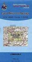
 | 356 - Topographische Landkarte Portugal 1:25.000 Carta Militar de Portugal - Série M888 Instituto Geográfico do Exército (IGeoE) - Portugal |
 | Nansen Land (Blatt 8) 1:500.000 Ultima Thule Serie (Gelbe Serie) Topographische Landkarte Saga Maps Grönland |
 | 0348-4 MURIEL DE LA FUENTE Topographische Landkarte 1:25.000 Spanien (Grundlage MTN25) Instituto Geográfico Nacional - CNIG Spanien - ProjektNord |
 | Budapest - Mad`arsko - Ungarn Stadtplan 1:20.000 / Landkarte 1:500.000 SHOCart |
 | N10 Fürstenfeldbruck - Olching, Schwabhausen, Puchheim, Mammendorf, Maisach, Odelzhausen ATK25 Topographische Karte 1:25.000 (Atkis) Bayern Landesvermessungsamt Bayern - Wanderkarte |
| Frederick E. Hyde Fjord (Blatt 9) 1:500.000 Ultima Thule Serie (Gelbe Serie) Topographische Landkarte Saga Maps Grönland |
 | Nord Dakota / Süd Dakota Landkarte 1:1.3 Mio. North Dakota / South Dakota State Map GM Johnson |
 | 2313-II-Sà Topographische Karte Dänemark 1:25.000 Topografisk kort Danmark (DTK/Kort25) 2313-II-Sà ProjektNord - Kort & Matrikelstyrelsen / Geodætisk Institut |
 | 0502 MATILLA DE LOS CAÃOS DEL RÃO Topographische Landkarte 1:50.000 Spanien (Grundlage MTN50) Instituto Geográfico Nacional - CNIG Spanien - ProjektNord |
 | 321 Topographische Landkarte Wanderkarte und Fahrradkarte Portugal 1:25.000 321 Mapa topográfico - Mapa de caminhadas - Portugal 1:25.000 ProjektNord |
 | 4920 Armsfeld - Wanderkarte mit Wanderwegen (geplottete Ausgabe) Topographische Landkarte Hessen 1:25.000 - ProjektNord (geplottete Ausgabe) |
 | 115 Sabrosa Topographische Landkarte Wanderkarte und Fahrradkarte Portugal 1:25.000 115 Mapa topográfico - Mapa de caminhadas - Portugal 1:25.000 ProjektNord |
 | 503 Topographische Landkarte Wanderkarte und Fahrradkarte Portugal 1:25.000 503 Mapa topográfico - Mapa de caminhadas - Portugal 1:25.000 ProjektNord |
 | 463 Topographische Landkarte Wanderkarte und Fahrradkarte Portugal 1:25.000 463 Mapa topográfico - Mapa de caminhadas - Portugal 1:25.000 ProjektNord |
| 16 Selvagem Grande - Ilhas Selvagens (Madeira) - Topografische Karte Portugal 1:25.000 Carta Militar de Portugal - Série P821 - 1/25 000 (Madeira) - Instituto Geográfico do Exército (IGeoE) - Portugal |
 | 110 Lanzo - Viù - Chialamberto - Locana - Ciriè - Topographische Wanderkarte 1:25.000 - IGC Italien |
 | 6438 Schnaittenbach Topographische Landkarte Bayern 1:25.000 - Normalausgabe - ProjektNord (geplottete Ausgabe) - Grundlage amtliche Topographische Karte Bayern DTK25 |
 | 2413-II-Sà Topographische Karte Dänemark 1:25.000 Topografisk kort Danmark (DTK/Kort25) 2413-II-Sà ProjektNord - Kort & Matrikelstyrelsen / Geodætisk Institut |
 | 708 Minas de Santa Quiteria Amtliche topographische Landkarte 1:50.000 Spanien (M.T.N.) 708 Mapa Topográfico Nacional de Espana (MTN50) Instituto Geográfico Nacional - CNIG Spanien |
 | 64 Donostia - San Sebastian (24-05) Amtliche topographische Landkarte 1:50.000 Spanien (M.T.N.) 64 Mapa Topográfico Nacional de Espana (MTN50) Instituto Geográfico Nacional - CNIG Spanien |