| << Portugal: Amtliche topografische Landkarten des Instituto Geográfico do Exército (IGeoE) 1:25.000 (Serie M888) |
||
|
||

Zuletzt angesehene Artikel:
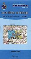
 | 349 Lourinhã- Topographische Landkarte Portugal 1:25.000 Carta Militar de Portugal - Série M888 Instituto Geográfico do Exército (IGeoE) - Portugal |
 | 3351 Neutrebbin Sonderausgabe mit Wanderwegen - Topographische Wanderkarte Brandenburg 1:25.000 ProjektNord |
 | 504 (14-20) Alba de Tormes Amtliche topographische Landkarte 1:50.000 Spanien (M.T.N.) 504 Mapa Topográfico Nacional de Espana (MTN50) Instituto Geográfico Nacional - CNIG Spanien |
 | 0334-1 GIRONA Topographische Landkarte 1:25.000 Spanien (Grundlage MTN25) Instituto Geográfico Nacional - CNIG Spanien - ProjektNord |
 | 4449-SO Topographische Karte 1:10.000 - Landesvermessungsamt Brandenburg |
 | 799 Santa Eulalia des RÃu - Ibiza Amtliche topographische Landkarte 1:50.000 Spanien (M.T.N.) 799 Mapa Topográfico Nacional de Espana (MTN50) Instituto Geográfico Nacional - CNIG Spanien |
 | 0293 BERGA Topographische Landkarte 1:50.000 Spanien (Grundlage MTN50) Instituto Geográfico Nacional - CNIG Spanien - ProjektNord |
 | 0321-3 MALLÃN Topographische Landkarte 1:25.000 Spanien (Grundlage MTN25) Instituto Geográfico Nacional - CNIG Spanien - ProjektNord |
 | Freiberger Mulde - Rechenberg-Bienenmühle (Blatt 26) Topographische Wanderkarte 1:25.000 mit Wanderwegen - ProjektNord |
 | 844 Ontur Amtliche topographische Landkarte 1:50.000 Spanien (M.T.N.) 844 Mapa Topográfico Nacional de Espana (MTN50) Instituto Geográfico Nacional - CNIG Spanien |
 | 722 Valencia Amtliche topographische Landkarte 1:50.000 Spanien (M.T.N.) 722 Mapa Topográfico Nacional de Espana (MTN50) Instituto Geográfico Nacional - CNIG Spanien |
 | 403 Monti Sibillini 1:25.000 4land Carta Topografica Escursionistica 4land |
 | 328 Artesa de Segre Amtliche topographische Landkarte 1:50.000 Spanien (M.T.N.) 328 Mapa Topográfico Nacional de Espana (MTN50) Instituto Geográfico Nacional - CNIG Spanien |
| 02-23-22 Modrá Topographische Karte 1:10.000 der Tschechischen Republik Zakladnà mapa Ceská republika - Cesky urad zememericky a katastralni - ProjektNord |
 | Bodensee, Motorradkarte 1:200.000, freytag & berndt Allgäu - Ostschweiz - Vorarlberg, mit Tourenbeschreibungen, GPX Tracks, wasserfest und reiÃfest - von freytag & berndt - Freytag-Berndt und ARTARIA |
 | 0845 YECLA Topographische Landkarte 1:50.000 Spanien (Grundlage MTN50) Instituto Geográfico Nacional - CNIG Spanien - ProjektNord |
| 02-24-06 Topographische Karte 1:10.000 der Tschechischen Republik Zakladnà mapa Ceská republika - Cesky urad zememericky a katastralni - ProjektNord |
 | 453 Fernao Ferro (Sesimbra) Topographische Landkarte Portugal 1:25.000 Carta Militar de Portugal - Série M888 Instituto Geográfico do Exército (IGeoE) - Portugal |
| 337 Alcañices Amtliche topographische Landkarte 1:50.000 Spanien (M.T.N.) 337 Mapa Topográfico Nacional de Espana (MTN50) Instituto Geográfico Nacional - CNIG Spanien |
 | 457 - Topographische Landkarte Portugal 1:25.000 Carta Militar de Portugal - Série M888 Instituto Geográfico do Exército (IGeoE) - Portugal |