| << Portugal: Amtliche topografische Landkarten des Instituto Geográfico do Exército (IGeoE) 1:25.000 (Serie M888) |
||
|
||

Zuletzt angesehene Artikel:
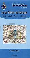
 | 300 - Topographische Landkarte Portugal 1:25.000 Carta Militar de Portugal - Série M888 Instituto Geográfico do Exército (IGeoE) - Portugal |
 | 3142-NO Topographische Karte 1:10.000 - Landesvermessungsamt Brandenburg |
 | C2326 Bad Oldesloe Topographische Landkarte 1:100.000 Landesvermessungsamt Schleswig-Holstein |
 | 3210 Klein BerÃen *** SCHNÃPPCHEN *** Amtliche topographische Karte 1:25.000 Landesvermessungsamt Niedersachsen |
 | 0444-4 CABACÃS Topographische Landkarte 1:25.000 Spanien (Grundlage MTN25) Instituto Geográfico Nacional - CNIG Spanien - ProjektNord |
 | 0777 MÃRIDA Topographische Landkarte 1:50.000 Spanien (Grundlage MTN50) Instituto Geográfico Nacional - CNIG Spanien - ProjektNord |
| 4550-NO Topographische Karte 1:10.000 - Landesvermessungsamt Brandenburg |
 | Grönland 1:7.1 Mio. Landkarte Grönland Saga Maps Kalaallit Nunaat - Grønland |
 | 0813-1 ALCUBILLAS Topographische Landkarte 1:25.000 Spanien (Grundlage MTN25) Instituto Geográfico Nacional - CNIG Spanien - ProjektNord |
 | 784 Ciudad Real Amtliche topographische Landkarte 1:50.000 Spanien (M.T.N.) 784 Mapa Topográfico Nacional de Espana (MTN50) Instituto Geográfico Nacional - CNIG Spanien |
 | 526 PROVENÃA Topographische Landkarte Wanderkarte und Fahrradkarte Portugal 1:25.000 526 Mapa topográfico - Mapa de caminhadas - Portugal 1:25.000 ProjektNord |
 | 286 Santiago de Litém (Pombal) Topographische Landkarte Wanderkarte und Fahrradkarte Portugal 1:25.000 286 Mapa topográfico - Mapa de caminhadas - Portugal 1:25.000 ProjektNord |
 | L6734 Neumarkt i. d. Oberpfalz (gedruckte Ausgabe) Topographische Karte Bayern 1:50.000 Bayerisches Landesvermessungsamt |
 | 454 Setúbal Topographische Landkarte Portugal 1:25.000 Carta Militar de Portugal - Série M888 Instituto Geográfico do Exército (IGeoE) - Portugal |
 | 0701 VALENCIA DE ALCÃNTARA Topographische Landkarte 1:50.000 Spanien (Grundlage MTN50) Instituto Geográfico Nacional - CNIG Spanien - ProjektNord |
 | 476 Topographische Landkarte Wanderkarte und Fahrradkarte Portugal 1:25.000 476 Mapa topográfico - Mapa de caminhadas - Portugal 1:25.000 ProjektNord |
 | 570 Amtliche topographische Landkarte 1:50.000 Spanien (M.T.N.) 570 Mapa Topográfico Nacional de Espana (MTN50) Instituto Geográfico Nacional - CNIG Spanien |
| 12 Ilhas Desertas (Madeira) - Topografische Karte Portugal 1:25.000 Carta Militar de Portugal - Série P821 - 1/25 000 (Madeira) - Instituto Geográfico do Exército (IGeoE) - Portugal |
 | 484-4 LA CABRERA Amtliche topographische Landkarte 1:25.000 Spanien (M.T.N.) 484-4 Mapa Topográfico Nacional de Espana (MTN25) Instituto Geográfico Nacional - CNIG Spanien |
 | 0477-1 SANDO Topographische Landkarte 1:25.000 Spanien (Grundlage MTN25) Instituto Geográfico Nacional - CNIG Spanien - ProjektNord |