Willkommen bei MapFox
Wurde Ihre Bestellung bestätigt? Wenn nicht - gab es evtl. ein SERVER-Problem! Bitte kontaktieren Sie uns! +++ Buchhändler-Anfragen erwünscht +++
Warenkorb
Artikel: 0 - € 0.00
Zur Kasse
Impressum Kontakt Versandkosten AGB
297 Leiria - Topographische Landkarte Portugal 1:25.000 Carta Militar de Portugal - Série M888 Instituto Geográfico do Exército (IGeoE) - Portugal
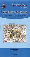
<< Portugal: Amtliche topografische Landkarten des Instituto Geográfico do Exército (IGeoE) 1:25.000 (Serie M888)
 
Cover

Gesamtliste mit Blattübersicht

Kartenbeispiel aus der Serie

Kartenausschnitt

297 Leiria - Topographische Landkarte Portugal 1:25.000 Carta Militar de Portugal - Série M888 Instituto Geográfico do Exército (IGeoE) - Portugal
EAN / ISBN: 9789727902897
Preis: EUR 17.90

Bestellartikel: versandfertig in ca. 2 Wochen oder länger. Dieser Artikel wird speziell für Sie bestellt. Keine Rücknahme!
Produkt EUR Anzahl Bestellen
297 Leiria - Topographische Landkarte Portugal 1:25.000 Carta Militar de Portugal - Série M888 Instituto Geográfico do Exército (IGeoE) - Portugal 17.90
Versandkostenfrei in Deutschland ab 30,- Bestellwert

incl. MwSt.

Stichworte, die bei der Suche nützlich sein könnten:
Leiria - Portugal - topografische Wanderkarten - Serie M888 - Série M888 - M888

Zuletzt angesehene Artikel:

Cover297 Leiria - Topographische Landkarte Portugal 1:25.000 Carta Militar de Portugal - Série M888 Instituto Geográfico do Exército (IGeoE) - Portugal

Noch kein Cover vorhanden1519 Simonsberg - Gestern und Heute - Historische Überlagerung 1902-1930 Topographische Landkarte 1:25.000 im Vergleich - Landesvermessungsamt Schleswig-Holstein / ProjektNord

CoverN622 Möhkö Topographische Karte 1:50.000 EUREF-FIN (Maastokarttat) Maanmittauslaitos / Lantmäteriverket Finnland - ProjektNord

CoverW524 Sevettijärvi Topographische Karte 1:50.000 EUREF-FIN (Maastokarttat) Maanmittauslaitos / Lantmäteriverket Finnland - ProjektNord

Noch kein Cover vorhanden1721 Tellingstedt - Gestern und Heute - Historische Überlagerung 1902-1930 Topographische Landkarte 1:25.000 im Vergleich - Landesvermessungsamt Schleswig-Holstein / ProjektNord

Cover453 Fernao Ferro (Sesimbra) Topographische Landkarte Portugal 1:25.000 Carta Militar de Portugal - Série M888 Instituto Geográfico do Exército (IGeoE) - Portugal

Cover79 Topographische Landkarte Wanderkarte und Fahrradkarte Portugal 1:25.000
079 Mapa topográfico - Mapa de caminhadas - Portugal 1:25.000 ProjektNord

Cover334 Topographische Landkarte Wanderkarte und Fahrradkarte Portugal 1:25.000
334 Mapa topográfico - Mapa de caminhadas - Portugal 1:25.000 ProjektNord

CoverP342 Mickelsörarna Topographische Karte 1:50.000 EUREF-FIN (Maastokarttat) Maanmittauslaitos / Lantmäteriverket Finnland - ProjektNord

Noch kein Cover vorhanden2223 Elmshorn - Gestern und Heute - Historische Überlagerung 1932-1950 Topographische Landkarte 1:25.000 im Vergleich - Landesvermessungsamt Schleswig-Holstein / ProjektNord

Noch kein Cover vorhanden1699 Goldap Topographische Karte 1:25.000 Messtischblatt des Deutschen Reiches - Preußische Landesaufnahme / Reichsamt für Landesaufnahme - Faksimile ProjektNord

Cover0936-1 PAGOS DE SIERRA Topographische Landkarte 1:25.000 Spanien (Grundlage MTN25) Instituto Geográfico Nacional - CNIG Spanien - ProjektNord

Cover280 Topographische Landkarte Wanderkarte und Fahrradkarte Portugal 1:25.000
280 Mapa topográfico - Mapa de caminhadas - Portugal 1:25.000 ProjektNord

Noch kein Cover vorhanden2128 Bad Oldesloe - Gestern und Heute - Historische Überlagerung 1902-1930 Topographische Landkarte 1:25.000 im Vergleich - Landesvermessungsamt Schleswig-Holstein / ProjektNord

Noch kein Cover vorhanden1532 Landkirchen(Fehmarn) - Gestern und Heute - Historische Überlagerung 1878-1880 Topographische Landkarte 1:25.000 im Vergleich - Landesvermessungsamt Schleswig-Holstein / ProjektNord

Cover57 Topographische Landkarte Wanderkarte und Fahrradkarte Portugal 1:25.000
057 Mapa topográfico - Mapa de caminhadas - Portugal 1:25.000 ProjektNord

Cover0779-1 VILLANUEVA DE LA SERENA Topographische Landkarte 1:25.000 Spanien (Grundlage MTN25) Instituto Geográfico Nacional - CNIG Spanien - ProjektNord

Cover0755-1 NAVALVILLAR DE PELA Topographische Landkarte 1:25.000 Spanien (Grundlage MTN25) Instituto Geográfico Nacional - CNIG Spanien - ProjektNord

CoverU513 Saija Topographische Karte 1:50.000 EUREF-FIN (Maastokarttat) Maanmittauslaitos / Lantmäteriverket Finnland - ProjektNord

Cover73 Topographische Landkarte Wanderkarte und Fahrradkarte Portugal 1:25.000
073 Mapa topográfico - Mapa de caminhadas - Portugal 1:25.000 ProjektNord