| << Portugal: Amtliche topografische Landkarten des Instituto Geográfico do Exército (IGeoE) 1:25.000 (Serie M888) |
||
|
||

Zuletzt angesehene Artikel:
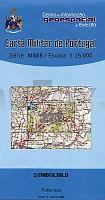
 | 277 - Topographische Landkarte Portugal 1:25.000 Carta Militar de Portugal - Série M888 Instituto Geográfico do Exército (IGeoE) - Portugal |
 | 50 Nyköping 1:50.000 (wasserfest) Topographische Wanderkarte - Sverigeserien Topo50 - Schweden Kartförlaget |
 | M-33-23-A/B Milicz Amtliche topographische Landkarte Polen 1:50.000 M-33-23-A/B Milicz - Mapa Topograficzna Polski Glowny Geodeta Kraju |
 | 0629-3 TOLEDO Topographische Landkarte 1:25.000 Spanien (Grundlage MTN25) Instituto Geográfico Nacional - CNIG Spanien - ProjektNord |
 | KOMPASS Wanderkarte Wilder Kaiser - Ellmau - Going - Scheffau - Söll 1:25.000 (Nr. 134) Wander- und Fahrradkarte in einem - inklusive Offline-Verwendung in der KOMPASS-App. Wander-& Radwege. Panorama. Skitouren. Langlaufen. Reiten - KOMPASS-Karten |
| M-33-19-A/B Zary Amtliche topographische Landkarte Polen 1:50.000 M-33-19-A/B Zary - Mapa Topograficzna Polski Glowny Geodeta Kraju |