| << Portugal: Amtliche topografische Landkarten des Instituto Geográfico do Exército (IGeoE) 1:25.000 (Serie M888) |
||
|
||

Zuletzt angesehene Artikel:
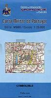
 | 149 - Topographische Landkarte Portugal 1:25.000 Carta Militar de Portugal - Série M888 Instituto Geográfico do Exército (IGeoE) - Portugal |
 | CC 4742 Riesa Topographische Ãbersichtskarte 1:200.000 - Bundesamt für Kartografie und Geodäsie und Landesvermessungsämter - ProjektNord |
 | 28M PAJALA 1:100.000 *** SCHNÃPPCHEN *** Wegekarte Schweden (Vägkarta/BlÃ¥ Kartan) - Kartförlaget - Lantmäteriet Landkarte Schweden |
 | Wien Riesenplan - Spiralbindung - Extra groÃe Schrift - 1:12.500 Stadtplan. Umgebungskarte, Durchfahrtsplan, Flughafen, Innenstadt, StraÃenverzeichnis - freytag & berndt |
 | P5323 Ruvaslahti Topographische Karte 1:25.000 EUREF (Peruskartta) Maanmittauslaitos / Lantmäteriverket Finnland - ProjektNord |
 | W4314 Topographische Karte 1:25.000 EUREF (Peruskartta) Maanmittauslaitos / Lantmäteriverket Finnland - ProjektNord |
 | Landschaftsschutzpark Weitsee Touristische Landkarte 1:50.000 Wanderkarte, Radwanderkarte, Freizeitkarte, Kanurouten, laminiert Wdzydzki Park Krajobrazowy laminowana mapa PLAN Galileos - Polen |
 | CC 2342 Stralsund Topographische Ãbersichtskarte 1:200.000 - Bundesamt für Kartografie und Geodäsie und Landesvermessungsämter - ProjektNord |
 | 1027 Güéjar Sierra Amtliche topographische Landkarte 1:50.000 Spanien (M.T.N.) 1027 Mapa Topográfico Nacional de Espana (MTN50) Instituto Geográfico Nacional - CNIG Spanien |
 | 17O EMMEN (Oost) Topographische Karte der Niederlande 1:50.000 Topografische Dienst (Plotausgabe) |
 | 13 Piedade (Pico ost - Azoren) - Topografische Karte Portugal 1:25.000 Carta Militar de Portugal - Série M889 - 1/25 000 (Acores) - Instituto Geográfico do Exército (IGeoE) - Portugal |
 | Parco Argentera - Zona Est - Alpi Marittime (Blatt AM-6) Topographische Wanderkarte 1:15.000 Carta dei Sentieri EdM - Edizioni del Magistero - Italien |
 | Libramont - Chevigny Wanderkarte - 10 Wanderungen Touristische Landkarte Belgien NGI Belgien |
| 183.13 Amtliche topographische Karte 1:25.000 Polen |
 | 12 Lajes do Pico (Pico - Azoren) - Topografische Karte Portugal 1:25.000 Carta Militar de Portugal - Série M889 - 1/25 000 (Acores) - Instituto Geográfico do Exército (IGeoE) - Portugal |
 | Naturpark Rhein-Westerwald (NRW) Topographische Wanderkarte u. Radwanderkarte 1:50.000 - Landesamt für Vermessung und Geobasisinformation Rheinland-Pfalz |
 | P5123 Toivala Topographische Karte 1:25.000 EUREF (Peruskartta) Maanmittauslaitos / Lantmäteriverket Finnland - ProjektNord |
 | Weimarer Radeltouren Radwanderführer von Philipp Heinrichs - Grünes Herz |
 | Mittleres Pilitza-Tal Wanderkarte 1:75.000 Wasserfeste Landkarte, Wanderkarte, Kanurouten Dolina Środkowej Pilicy Compass - Polen |
| Erläuterungen zur Geologischen Karte 5143 Chemnitz - Ausgabe 2010 Sächsisches Landesamt für Umwelt, Landwirtschaft und Geologie |