| << Portugal: Amtliche topografische Landkarten des Instituto Geográfico do Exército (IGeoE) 1:25.000 (Serie M888) |
  | |
|
||
Zuletzt angesehene Artikel:
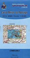
![]() | 109 - Topographische Landkarte Portugal 1:25.000 Carta Militar de Portugal - Série M888 Instituto Geográfico do Exército (IGeoE) - Portugal |
![]() | 922 (15-37) Villarubia Amtliche topographische Landkarte 1:50.000 Spanien (M.T.N.) 922 Mapa Topográfico Nacional de Espana (MTN50) Instituto Geográfico Nacional - CNIG Spanien |
![]() | 243 Calahorra Amtliche topographische Landkarte 1:50.000 Spanien (M.T.N.) 243 Mapa Topográfico Nacional de Espana (MTN50) Instituto Geográfico Nacional - CNIG Spanien |
![]() | 752 (11-30) Mirandilla Amtliche topographische Landkarte 1:50.000 Spanien (M.T.N.) 752 Mapa Topográfico Nacional de Espana (MTN50) Instituto Geográfico Nacional - CNIG Spanien |
![]() | DUMONT Reise-Taschenbuch Dresden & Sächsische Schweiz von Klose, Siiri |
![]() | Bergisches Land - Königsforst Topographische Wanderkarte Nordrhein-Westfalen mit Wanderwegen und Radwegen 1:25.000 - ProjektNord |
![]() | 5707 Kelberg - Wanderkarte mit Wanderwegen (geplottete Ausgabe) ProjektNord - Grundlage Amtliche topographische Karte Landesamt für Vermessung und Geobasisinformation Rheinland-Pfalz |
![]() | 197 Carrión de los Condes Amtliche topographische Landkarte 1:50.000 Spanien (M.T.N.) 197 Mapa Topográfico Nacional de Espana (MTN50) Instituto Geográfico Nacional - CNIG Spanien |
![]() | 585 Monchique Topographische Landkarte Portugal 1:25.000 Carta Militar de Portugal - Série M888 Instituto Geográfico do Exército (IGeoE) - Portugal |
![]() | 941 (13-38) Mulva Amtliche topographische Landkarte 1:50.000 Spanien (M.T.N.) 941 Mapa Topográfico Nacional de Espana (MTN50) Instituto Geográfico Nacional - CNIG Spanien |
![]() | 218 - Topographische Landkarte Portugal 1:25.000 Carta Militar de Portugal - Série M888 Instituto Geográfico do Exército (IGeoE) - Portugal |
![]() | 2493 Altkirchen (Ostpreußen) Topographische Karte 1:25.000 Messtischblatt des Deutschen Reiches - Preußische Landesaufnahme / Reichsamt für Landesaufnahme - Faksimile ProjektNord |
![]() | Pilat - le PNR du Pilat à pied 22 promenades & randonnées *** SCHNÄPPCHEN *** - Réf. PN05 Topographischer Wanderführer - FFRP (Fédération française de randonnée pédestre) Frankreich |
![]() | 2011 02+14 Farten Topographische Karte 1:20.000 (Maastokartta / Peruskartta / Grundkarta) Maanmittauslaitos / Lantmäteriverket Finnland - ProjektNord |
![]() | Skye`s Cuillin Ridge Traverse - Strategies, advive, detailed topo booklet and 10 classic scrambles Wanderführer Schottland - Cicerone Großbritannien (englisch) |
![]() | 2215-II-SØ Topographische Karte Dänemark 1:25.000 Topografisk kort Danmark (DTK/Kort25) 2215-II-SØ ProjektNord - Kort & Matrikelstyrelsen / Geodætisk Institut |
![]() | 23 - Vinhais Topographische Landkarte Portugal 1:25.000 Carta Militar de Portugal - Série M888 Instituto Geográfico do Exército (IGeoE) - Portugal |
![]() | 212 - Topographische Landkarte Portugal 1:25.000 Carta Militar de Portugal - Série M888 Instituto Geográfico do Exército (IGeoE) - Portugal |
![]() | Sierra de Guadarrama Wanderkarten 1:25.000 Nationalparks Spanien - Sierra de Guadarrama Nationalpark - CNIG Spanien |


